
Prelude: A Cable Car to the Sky
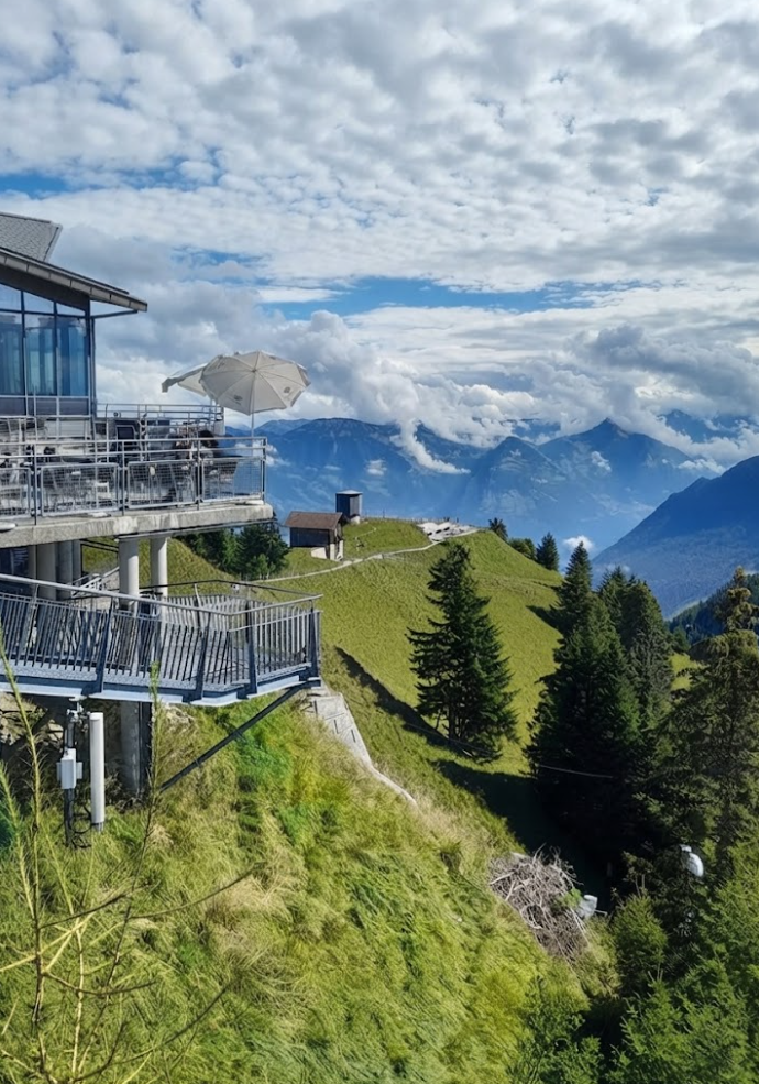
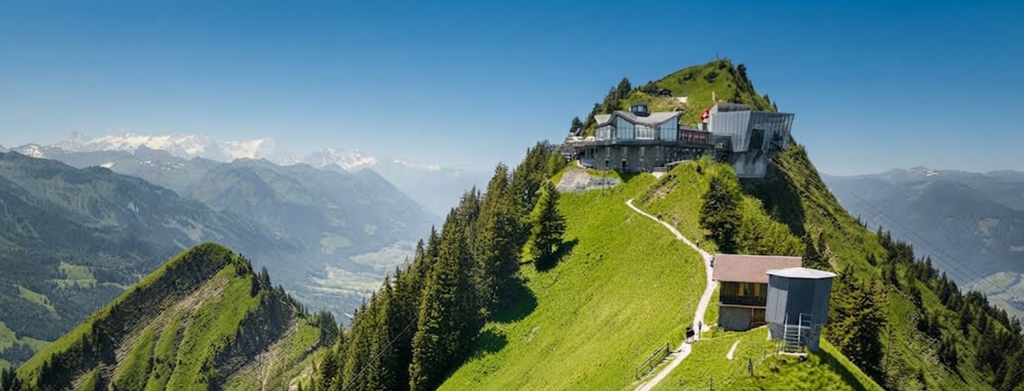
The adventure begins in Stans, a quiet town in the canton of Nidwalden. From here, the CabriO cable car lifts you into the alpine world. This double-deck marvel is unique worldwide: its open-air upper deck allows you to stand in the wind, surrounded by a panorama of Central Switzerland. Pilatus rises to the west, Lake Lucerne glimmers below, and the distant Alps form a jagged horizon.
At nearly 1,900 meters above sea level, the Stanserhorn summit offers a 360-degree view that feels like a prologue to the ridge walk ahead.
The Descent to Ächerlipass
Leaving the summit, the trail descends toward the Ächerlipass. This section is gentle, winding through meadows and forest. It is a chance to settle into rhythm, to adjust your pack, and to feel the solitude of the Tell Trail. Unlike the crowded paths of Zermatt or Rigi, this stage remains lightly traveled. The silence is broken only by cowbells and the crunch of boots on gravel.
The Arvigrat Ascent
The climb to the Arvigrat is steep and demanding. In just 2.5 kilometers, the trail rises 599 meters. Roots and rocks mark the path, and switchbacks cut through the Arvi forest. Emerging above the treeline, the reward is immense: the Engelberg valley, Sarner valley, and distant Bernese Alps spread out in a vast panorama. At 2,000 meters, the ridge feels like a balcony suspended between valleys.
Ächerlipass to Arvigrat: A Balcony Between Valleys
The trail from Ächerlipass to Arvigrat is not a gentle stroll. It is a climb into the sky, a demanding loop that tests stamina and rewards persistence with views so vast they feel like a secret revealed only to those who dare. At 7.9 kilometers, with 592 meters of elevation gain, the hike is short in distance but steep in spirit.
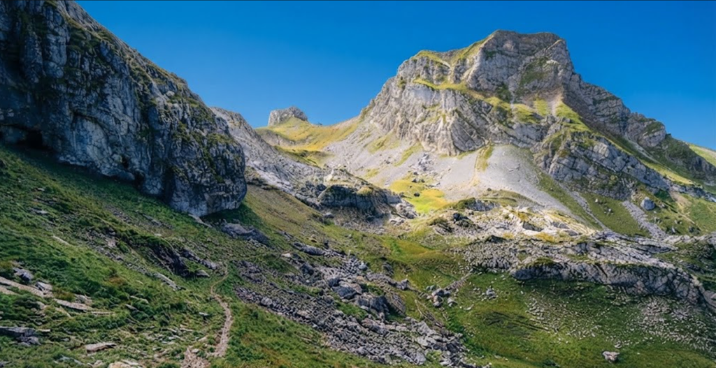
In 3.5 to 3.9 hours, you ascend from the quiet pass at 1458 meters to the ridge of Arvigrat at 2013 meters, a balcony suspended between valleys, forests, and alpine horizons.
The Ascent: Into the Arvi Forest
The climb begins abruptly. In just 2.5 kilometers, the trail rises nearly 599 meters, a relentless push through roots, rocks, and switchbacks. The Arvi forest closes around you, its canopy thick, its floor tangled with undergrowth. The air is damp, earthy, alive with the scent of pine and soil.
Each step feels heavier than the last, yet the rhythm of ascent carries you forward. The forest is not silent. Birds call from hidden branches, insects hum in the undergrowth, and the crunch of boots on stone becomes its own steady percussion. The climb is demanding, but it is also intimate — a passage through a living cathedral of trees.
Breaking the Treeline
Emerging above the treeline is a moment of revelation. The Engelberg valley opens to the east, the Sarner valley to the west, and beyond them the Bernese Alps rise in jagged silhouettes. At 2000 meters, the ridge feels impossibly suspended, a balcony between worlds. The air thins, the horizon expands, and the effort of the climb dissolves into awe.
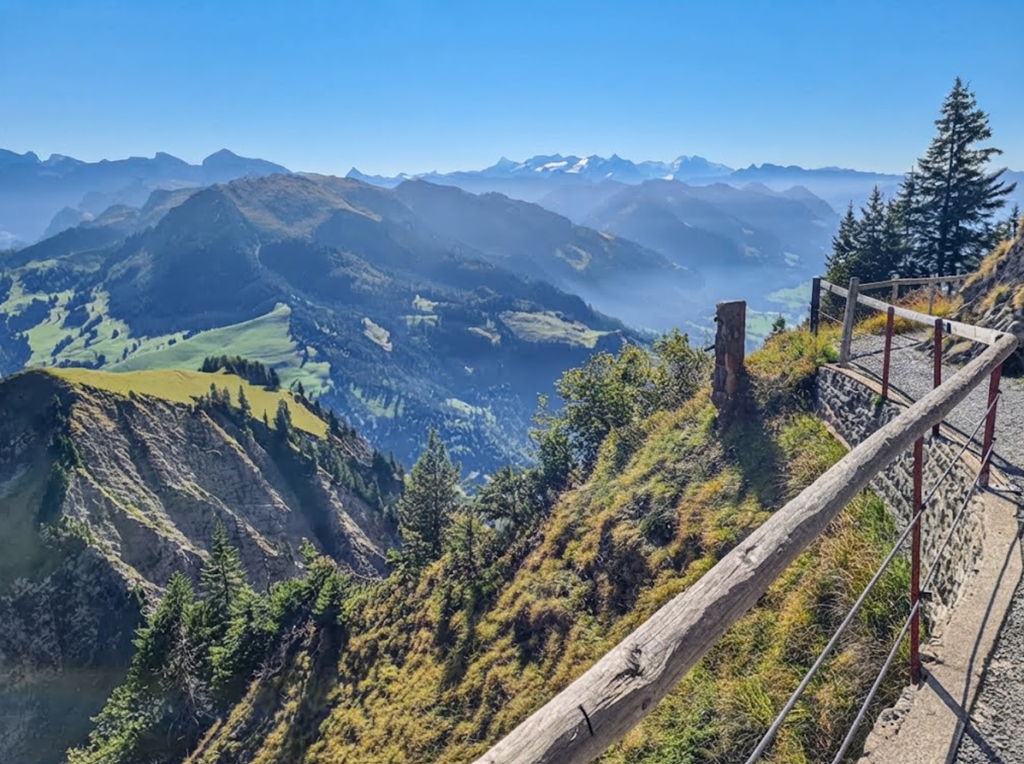
Here, wildflowers scatter across alpine meadows, their colors vivid against the muted greens and greys of the ridge. In summer, the slopes are alive with yellows, purples, and whites, a fleeting tapestry that shifts with the wind. In winter, the same ridge lies buried under snow, icy and treacherous, often impassable without proper gear.
The Ridge Walk
The Arvigrat ridge is narrow but steady, a path that traces the spine of the mountain. Walking here feels like balancing between valleys, each step accompanied by sweeping views. To the north, Nidwalden’s rolling hills fade into lakes and villages. To the south, the Alps rise higher, sharper, more dramatic.
The ridge is not only about views. It is about perspective. Standing here, you sense the geography of Switzerland laid out in layers — valleys carved by rivers, forests clinging to slopes, peaks etched against the sky.
The Descent: Clockwise Ease
The loop is best walked clockwise. The steep climb comes first, demanding energy while legs are fresh. The descent, though long, is gentler, winding back through forested slopes where roots and rocks are less punishing. The path leads downward in curves rather than drops, easing the strain on knees and allowing time to savor the landscape.
Ticks are a quiet hazard in the lower forest, a reminder that beauty often carries risk. Long trousers and vigilance are small prices to pay for safety.
Seasons of the Trail
In summer, the hike is vibrant. Meadows bloom, forests hum, and the ridge feels alive with color and sound. The trail is demanding but welcoming, its challenges softened by warmth and light. In autumn, the forest burns with gold and red, leaves crunching underfoot, air crisp and clear. The ridge becomes a place of solitude, quieter, more contemplative.
Winter transforms the trail into something harsher. Snow buries the path, ice slicks the rocks, and maintenance ceases. The ridge is beautiful but dangerous, a place for those with gear, caution, and experience. Spring brings renewal. Meltwater trickles down slopes, wildflowers return, and the forest breathes again. The trail reopens, inviting hikers back into its rhythm.
The Reward
The reward of the Ächerlipass to Arvigrat hike is not only the view. It is the feeling of having earned a place on the ridge, of standing where valleys meet and horizons stretch endlessly. It is the balance between effort and awe, between challenge and beauty.
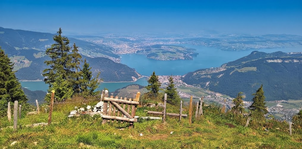
At 2015 meters, the ridge is not the highest peak in Switzerland, but it is one of the most revealing. It shows the country in miniature — forests, valleys, meadows, and mountains — all visible from a single balcony in the sky.
The Ridge Walk: Gräfimattgrat to Wagenleis
This is the heart of stage five. The newly opened ridge path along the Gräfimattgrat is narrow, exposed, and exhilarating. Drop-offs plunge on either side, and the trail demands focus. The Wagenleis rock passage is the key section: a notch in the ridge secured with thick ropes.
Here, surefootedness and a head for heights are essential. The ridge continues over the Schluchigrat, each step a balance between caution and awe.
Storeggpass — A Gateway in the Mountains
The ridge delivers you to the Storeggpass, a natural gateway between valleys. At 1,745 metres, it feels both exposed and welcoming. The wind funnels through, carrying scents of larch and echoes of distant cowbells. Many hikers pause here, not only to catch breath but to absorb the sense of transition.
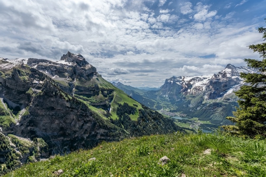
The pass is a threshold, a place where effort meets anticipation. Beyond it lies Engelberg, but between here and there are lakes, climbs, and moments of quiet reflection.
Lake Luter — A Mirror of Calm
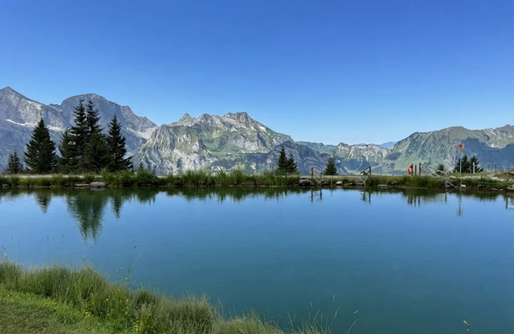
Just beyond the pass lies Lake Luter, a small alpine jewel cradled by slopes. Its waters are still, reflecting clouds and sky with perfect clarity. The lake is modest in size, yet immense in atmosphere. Hikers dip hands into its cold surface, the shock of glacial water a reminder of altitude. Some sit on its grassy banks, boots off, toes brushing the edge.
Others simply stand, gazing at the mirror, gathering strength for the climb ahead.Lake Luter is not just a pause; it is a gift. A moment of calm before exertion, a reminder that the trail is not only about movement but also about stillness.
The Bocki Summit
From Lake Luter, the trail rises sharply toward Bocki, the highest point of the stage at 2,155 meters. The slope is demanding, a test of endurance after the respite of water. Muscles burn, lungs tighten, and yet the rhythm of steps carries you upward. The reward is not immediate. The climb is long, the gradient unforgiving.
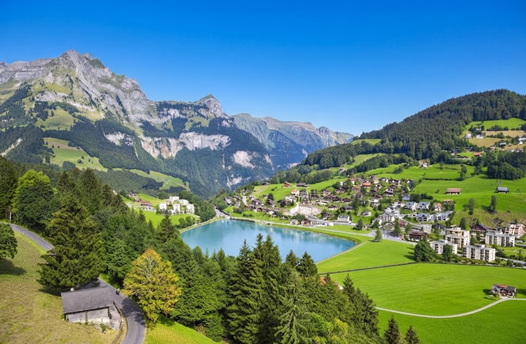
But each switchback reveals new angles of the valley, new glimpses of peaks beyond. The effort becomes its own meditation, a dialogue between body and mountain. From here, the descent begins. The trail drops steeply toward Engelberg, passing the Haltenhütte refuge and the Untertrübsee alpine dairy. The dairy is a highlight in itself: traditional Sbrinz cheese is made here, and hikers often stop for a hearty snack before continuing.
Engelberg: The Destination
The trail ends in Engelberg, a resort town famous for Mt. Titlis. Engelberg appears gradually, first as a cluster of rooftops, then as a village framed by peaks. After nearly 25 kilometers, 1,501 meters of ascent, and 2,375 meters of descent, the arrival feels triumphant. Engelberg’s streets, framed by peaks, offer rest, food, and connection back to the wider world.
Overnight at Alp Laucheren
For those who split the stage into two days, Alp Laucheren is the perfect stop. The Niederberger family has tended sheep here for generations. Tents dot the ridge, and sunrise over the mountains is unforgettable, making this overnight stay a blend of alpine hospitality and wilderness immersion.
Route Variants
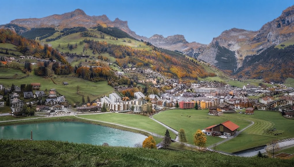
Shortcut from Lutersee: Turn toward Alp Zingel for a shorter return to Engelberg.
Buiräbähnli Option: From Storeggpass, descend to Eggen and take one of the valley’s small cable cars down to Mettlen. From there, a short walk leads to Grafenort station, and the train returns you to Engelberg.
Practical Notes
Walking Time: Approximately 10 hours
Distance: 25.1 km
Elevation Gain: 1,501 m
Elevation Loss: 2,375 m
Transport: From Zurich airport, trains connect to Lucerne every half hour. From Lucerne, the Zentralbahn takes you to Stans. The Stanserhorn cable car station is a 5-minute walk from the train.
By Car: Take the A2 to Stans Nord. Parking is available in the village and at the cable car valley station.
Why Stage Five Matters
The Tell Trail was created in 2020, linking eight stages across 208 kilometers. It passes the “big six” mountains of Central Switzerland: Stoos, Rigi, Pilatus, Stanserhorn, Titlis, and Brienzer Rothorn. Stage five is its most dramatic section, combining technical ridge walking, alpine hospitality, and authentic solitude.
Unlike the crowded trails of Zermatt or Grindelwald, this path remains lightly traveled, offering a genuine Swiss hiking experience.
Packing and Preparation
Stage five is long and demanding. A sleeping bag, water, flashlight, sunscreen, rain jacket, and hiking poles are essential. Unless you are used to carrying heavy loads, leave full-frame cameras and unnecessary electronics at home. The ridge requires concentration, and lighter packs make the journey safer and more enjoyable.
Seasonal Impressions
In late summer, the grass along the ridge turns golden. Goats linger on the slopes, soaking in the last rays of sun before temperatures drop. Autumn brings crisp air and sharper views, while spring offers wildflowers along the meadows. Each season reshapes the experience, but the ridge remains constant: exposed, dramatic, and unforgettable.
Cultural Notes
Switzerland is a country of hikers. Trails like the Tell Trail reflect this tradition, connecting valleys, passes, and peaks. Stage five embodies the spirit of Swiss hiking: technical yet accessible, remote yet connected by public transport, demanding yet rewarding. The alpine dairies along the way remind hikers that these ridges are not just wilderness but working landscapes, shaped by families who have lived here for generations.