
Faroe Islands > Things to do in Faroe Islands > Villingardalsfjall
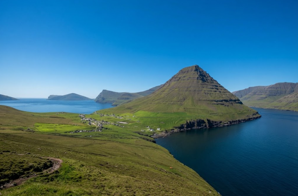
At the northern tip of the Faroe Islands lies Viðareiði, a small settlement perched on a slender isthmus between two seas. From here, hikers can tackle one of the archipelago’s most memorable climbs: Villingadalsfjall. Rising to 841 meters, it is the third‑highest mountain in the Faroes, a steep and rugged ascent that rewards those who reach the summit with sweeping views of surrounding islands and the Atlantic Ocean.
This hike is not for the faint‑hearted. The trail is short in distance but relentless in gradient, climbing nearly 830 meters in just 4.5 kilometers. The terrain shifts from grassy slopes to loose basalt stones, demanding careful footing and steady determination. Yet for those prepared to face the challenge, Villingadalsfjall offers one of the most dramatic panoramas in the North Atlantic.

Trail Overview
The hike begins at the end of Garðsvegur Road in Viðareiði, where a small parking area accommodates only a handful of cars. At the trailhead, a gate and honesty box mark the start of the climb. Access is across private property, and hikers must pay a fee of 200 DKK per person in cash before proceeding.
From here, the path rises immediately. The first section crosses farmland, with a paved track leading toward the mountain. Soon, the trail turns grassy, climbing between a stone wall and a stream. Blue posts mark the route, guiding hikers steadily upward.
The statistics are straightforward:
- Distance: 4.5 km out‑and‑back
- Elevation Gain: 829 m
- Time Needed: 3.5–4 hours
- Difficulty: Moderately difficult, steep gradient
Though the numbers suggest a moderate hike, the reality is more demanding. The path leads straight up the mountain, with few switchbacks to ease the climb.
The Ascent
The first half of the hike is grassy and muddy, with the trail etched clearly across the hillside. As elevation increases, the terrain becomes rockier, with loose stones underfoot. The gradient remains steep throughout, requiring steady pacing and frequent pauses.
After about 90 minutes, hikers reach a plateau marked by cairns and pointed stones. Though it resembles a ritual site, the cairns are mostly the result of local pranks and traditions. This plateau offers the first major viewpoint, with expansive vistas across the surrounding islands.
From here, the trail continues upward for another 80 meters of elevation gain. A junction appears: straight ahead lies the route to Cape Enniberg, while a right turn leads to the summit of Villingadalsfjall. The final stretch is a rocky slope, barren and exposed, taking about ten minutes to climb.
The Summit
The top of Villingadalsfjall is marked by a post and a circle of cairns. Unlike sharp pinnacles, the summit is a dome‑shaped plateau, offering space to wander and take in the views.
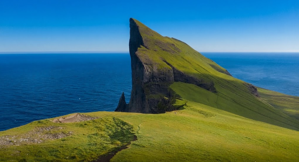
On clear days, the panorama is extraordinary. To the south, Malinsfjall rises in a perfect cone. To the west, the islands of Borðoy, Kunoy, and Kalsoy stretch across the horizon, their ridges sharp against the sea. To the east, Fugloy and Svínoy emerge from the Atlantic.
Most striking of all is Cape Enniberg, one of the highest sea cliffs in the world at 754 meters. From the summit, it lies only 1.5 kilometers away along the ridge. Extending the hike to Enniberg requires a professional guide, as the route is difficult to navigate and prone to fog.
Weather Considerations
The Faroe Islands are notorious for unpredictable weather. Conditions can change within minutes, with clouds sweeping across the summit and obscuring the trail. Strong winds are constant, even on clear days.
The best season for this hike is between March and November. Winter months bring snow and ice, making the trail hazardous. Even in summer, temperatures remain mild, ranging between 5–12°C, often accompanied by wind and rain. With more than 250 days of showers annually, hikers should dress in layers, wear sturdy boots, and carry a windproof, rain‑resistant jacket.
If fog descends during the climb, it is wise to turn back. The summit is barren and featureless, and route‑finding becomes difficult in poor visibility.
Safety and Difficulty
Though classified as moderately difficult, the hike demands caution. The steep gradient and loose rocks make the ascent strenuous and the descent slippery. Children under eight are not recommended to attempt the trail.
Key safety points:
- Take the climb slowly and pace yourself.
- Watch footing on loose stones, especially during descent.
- Avoid hiking in fog, snow, or icy conditions.
- Carry sufficient water and snacks, as there are no facilities on Viðoy Island.
Geological Context
The Faroe Islands were once an ancient volcanic hotspot. Though eruptions ceased long ago, the landscape remains shaped by basalt formations and rugged cliffs. Villingadalsfjall exemplifies this volcanic past, with its rocky slopes and dramatic seascapes.
The terrain is a mix of grassy lower slopes and stony upper ridges, reflecting the island’s geological history. For hikers, this means both beauty and challenge: sweeping views across volcanic landscapes, but also uneven footing and steep gradients.
Cultural and Historical Notes
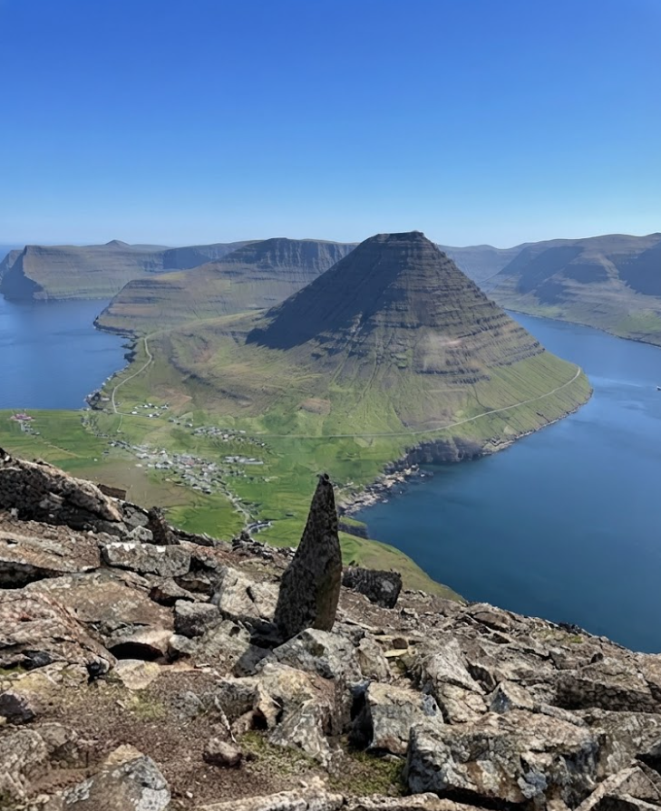
Viðareiði, the starting point of the hike, is the northernmost village in the Faroes. Its settlement dates back to between 1350 and 1400. Positioned on a narrow isthmus, the village is flanked by mountains and seas, a location both vulnerable and remarkable.
From the trail, hikers can appreciate the village’s extraordinary setting. Cradled between two mountains and surrounded by water, Viðareiði appears both isolated and resilient. The decision to settle here centuries ago speaks to the daring spirit of its inhabitants.
Logistics and Access
Reaching Viðareiði requires a one‑hour drive from Tórshavn, the capital of the Faroe Islands. Tórshavn offers the widest range of accommodations, restaurants, and transport connections. Many travelers base themselves there and take day trips across the archipelago.
On Viðoy Island, facilities are minimal. There are no cafés, gas stations, or shops, so hikers must bring supplies with them. Parking near the trailhead is limited, with space for only 8–9 cars.

The hiking fee of 200 DKK per person must be paid in cash at the honesty box by the gate. Signs at the trailhead warn against hiking in snow or fog.
Extension to Cape Enniberg
For experienced hikers, the climb can be extended to Cape Enniberg. This cliff rises 754 meters directly above the sea, making it one of the highest sea cliffs in the world. The route from Villingadalsfjall follows the ridge northward, but it is mandatory to hire a guide. Fog and poor visibility make navigation difficult, and the terrain is hazardous.
Guided tours to Enniberg are available from Tórshavn, combining transport to Viðareiði with professional guidance along the ridge.
The Experience
The hike to Villingadalsfjall is demanding but unforgettable. Every stage offers new perspectives: the grassy slopes above Viðareiði, the rocky ascent toward the plateau, and the final barren climb to the summit. The views are vast and varied, shifting with the weather and light.
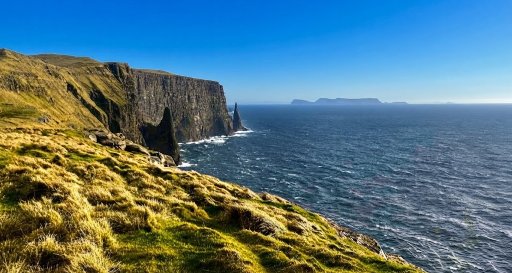
At the top, the panorama is unmatched. Islands rise from the ocean in every direction, cliffs plunge into the sea, and the village lies far below, a fragile thread of life at the edge of the world.
Villingadalsfjall is more than a hike; it is an encounter with the raw landscapes of the Faroe Islands. The climb is steep, the terrain rugged, and the weather unpredictable. Yet for those who reach the summit, the reward is immense: a 360‑degree seascape, a glimpse of Cape Enniberg, and the satisfaction of standing atop one of the highest peaks in the archipelago.
This is a hike for prepared and experienced walkers, best attempted in fair weather and with proper gear. It is a journey into unspoiled nature, a demanding ascent that leaves lasting memories.