
Faroe Islands > Things to do in Faroe Islands > Eysturoy
Gateway to Eysturoy
Eysturoy, the “East Island,” is the second largest in the Faroese archipelago, both in size and population. It is impossible to visit the Faroes without crossing its terrain, for it lies directly on the path between the capital Tórshavn and the northern islands. The Brúgvin um Streymin — “Bridge over the Atlantic” — connects Eysturoy to Streymoy, the largest island. This is the only bridge in the Faroes that spans two islands, arching across Sundini, the longest sound in the country. At Streymurin, the narrowest point, currents swirl into perilous eddies, a reminder of the sea’s power even beneath a seemingly calm surface.

The island is also linked by the Eysturoyartunnilin, an undersea tunnel that dives beneath fjords to connect Runavík with Strendur and Tórshavn. Another tunnel leads north to Klaksvík, gateway to the rugged Northern Isles. These engineering feats make Eysturoy accessible, but the island is far more than a transit corridor. It is a landscape of mountains, fjords, folklore, and villages that preserve centuries of Faroese life.
Funningur and the Fjord
On the northwest coast lies Funningur, a settlement nestled at the head of Funningsfjørður. The village is framed by steep slopes, its houses clustered against the bay. Tradition holds that Funningur was one of the earliest Viking settlements in the Faroes, a place where Norse seafarers first anchored their boats. Today, it remains small and quiet, yet atmospheric, with the fjord stretching inland like a silver ribbon.
From Funningur, the road climbs sharply into the mountains. The serpentine ascent shrinks the village into miniature below, while peaks rise in every direction. This road leads to Gjáarskarð Pass, where a modest trailhead marks the start of the walk to Hvíthamar.

Hvíthamar Viewpoint
The trail to Hvíthamar is short and gentle, only two kilometres along a ridge line. It is accessible to most visitors, offering a reward far greater than the effort required. At the viewpoint, a railing marks the cliff edge, where the land drops steeply into Funningsfjørður. The panorama is vast: mountains layered in shades of green and grey, the fjord winding inland, and the sea glimmering beyond.
This outlook has become one of the most photographed in the Faroes, yet it retains a sense of solitude. The wind sweeps across the ridge, carrying the cries of seabirds. The view is timeless, unchanged since Viking eyes first gazed upon it.
Gjógv and the Gorge
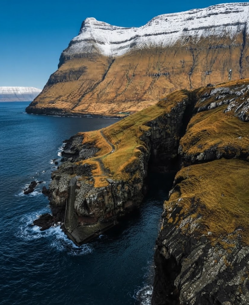
A short drive north lies Gjógv, a village named for its defining feature — a 200‑metre gorge filled with seawater. This natural harbour once sheltered fishing boats, its basalt walls protecting them from storms. The village itself is compact, with turf‑roof houses, colourful buildings, and streams bridged by stone arches. A paved walkway guides visitors through the lanes to the lookout at the mouth of the gorge, where waves surge against the rocks.
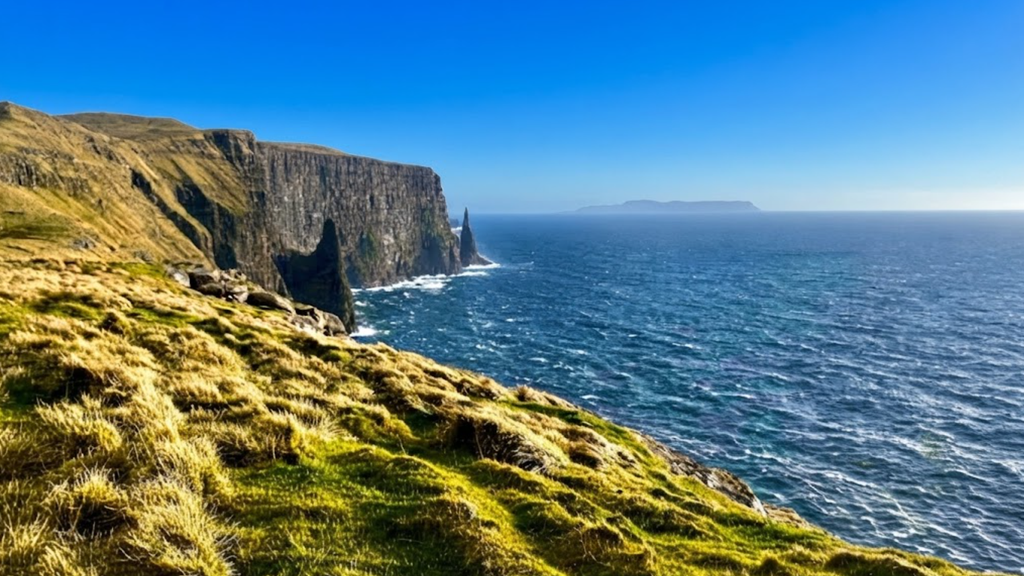
Gjógv is home to only fifty residents, yet it offers hospitality that surprises many. The Gjógv Guesthouse Restaurant serves refined dishes: halibut carpaccio, goat cheese salad, and risotto, a menu unexpected in such a remote place. The village balances heritage and modern comfort, making it a highlight of any Faroese itinerary.
Eiði and Viking Roots
Southwest of Gjógv lies Eiði, spread across a flat isthmus between lake and sea. Once the second largest town in the Faroes, it remains a fishing community with deep Viking roots. The heritage museum Látrið, housed in a turf‑roof farmhouse, preserves artefacts of daily life, offering glimpses into the past.
Eiði’s lake, Tjørnin, is peaceful, often dotted with swans. Yet folklore warns of the Nykur, a shapeshifting water horse said to lure villagers onto its back before plunging into the depths.

Eiðiskollur and the Sea‑Stacks
Above the village rises Eiðiskollur Cliff, crowned by the ruins of a World War II watchtower. The summit offers sweeping views: the shining sea, the slopes of Slættaratindur, and the sea‑stacks Risin og Kellingin. Legend tells of a giant and a witch from Iceland who tried to drag the Faroes away, only to be turned to stone by the rising sun. The stacks remain as silent witnesses to the tale.
Crossing the Mountains
From Eiði, the road climbs toward Eiðisskarð Pass. On one side stands Vaðhorn, on the other Slættaratindur, the highest peak in the Faroes at 882 metres. The ascent to the summit is steep but manageable, leading to a broad plateau where, on clear days, all eighteen islands can be seen.
During the summer solstice, locals gather here to watch the midnight sun. Some claim that on exceptionally clear days, the glint of Iceland’s glaciers is visible 550 kilometres away — a sightline said to be the longest on earth. Whether myth or reality, the view from Slættaratindur is among the most breathtaking in the North Atlantic.
Runavík and Fuglafjørður
In the south, Runavík and Fuglafjørður form bustling hubs of commerce and fishing. Runavík is a centre for shipping and industry, while Fuglafjørður is known for its harbour and cultural life. These towns contrast with the quiet villages of the north, yet they remain rooted in the sea, their economies tied to fishing and trade.
Elduvík and the Eastern Shore
On the eastern coast lies Elduvík, a small village overlooking the fjord. Its houses are scattered along the shore, and a stream runs through the settlement. Elduvík is known for its tranquillity, a place where the rhythm of life is slow and the sea dominates the horizon.
Folklore and Festivals
Eysturoy is rich in folklore, from the Nykur of Eiði to the legends of giants and witches. These stories are woven into the landscape, giving meaning to rocks, lakes, and cliffs. The island is also home to one of the world’s most unique music festivals, held in Gøta. Here, international artists perform against a backdrop of mountains and sea, blending modern culture with ancient surroundings.

Hiking and Nature
Eysturoy offers diverse hiking opportunities. The Barmur Trail from Gjógv is well‑laid out, providing scenic views of valleys and fjords. Walks around Eiði lead to lakes and cliffs, while the climb to Slættaratindur challenges those seeking altitude. Each path reveals new perspectives, from serene waters to dramatic peaks.
Eysturoy is more than a link in the Faroese road system. It is an island of contrasts: bustling towns and quiet villages, folklore and modern festivals, gentle walks and demanding climbs. From Funningur’s fjord to Gjógv’s gorge, from Eiði’s legends to Slættaratindur’s summit, the island offers a journey through nature, history, and myth.
For travellers, Eysturoy is unforgettable — a place where every turn of the road reveals another story, another view, another moment suspended between sea and sky.