
Faroe Islands > Things to do in Faroe Islands > Klakkur
Klakkur is one of the most accessible yet rewarding hikes in the Faroe Islands. Rising above Klaksvík on Borðoy Island, this panoramic ridge offers sweeping views of Kalsoy, Kunoy, and the surrounding fjords. It is a walk that combines modest effort with extraordinary scenery, making it a favorite among locals and visitors alike.
Why Klakkur Matters
The Faroe Islands are defined by their rugged landscapes, unpredictable weather, and the interplay of sea and mountain. Klakkur embodies all of these qualities in a compact hike. At 413 meters, it is not the tallest peak in the archipelago, but its position above Klaksvík makes it a natural lookout. The ridge is broad, flat-topped, and easy to reach, yet the views are mythic. For photographers, couples, and casual walkers, Klakkur is a destination that feels both intimate and expansive.

Klaksvík – The Gateway to the Northern Isles
Klaksvík is the second largest town in the Faroe Islands, located on Borðoy Island. It is a hub for the Northern Isles, with ferry connections to Kalsoy and road links to Kunoy and Viðoy. The town itself sits between two U-shaped inlets, creating a sheltered harbor. From here, Klakkur rises directly to the northwest, visible from almost anywhere in town. Locals often point to the ridge when asked about nearby walks, and many refer to the route as Ástarbreytin, the “Love Path.”
Getting to the Trailhead
There are two main approaches to Klakkur. The first begins in Klaksvík town center, extending the hike to around 9.2 km. The second, more popular option, is to drive up Niðan Horn road to the water tanks car park. This shortens the hike to 6.2 km out-and-back, with an elevation gain of 277 meters. The road is gravel but well-surfaced, and a standard 2WD car is sufficient.
From Tórshavn, the capital of the Faroe Islands, the drive to Klaksvík takes about 45 minutes, covering 40 km. Car hire is available at Vágar Airport and in Tórshavn, with major companies such as Avis, Budget, and Europcar. Public bus line 400 also connects Tórshavn to Klaksvík, though this adds time and limits flexibility.

The Love Path – Ástarbreytin
Starting at the water tanks car park, the gravel road climbs gently toward the Hálsur saddle. This section is known as Ástarbreytin, or the “Love Path.” It is a popular walking area among locals, often used for evening strolls. The road passes farm buildings and grazing sheep, with Klaksvík visible below. The atmosphere is pastoral, a transition from town to mountain.
Hálsur Saddle – The Gateway to Klakkur
At Hálsur, the road reaches a small car park and an information board. A gate leads you past a reservoir and onto a footpath. Timber stairs ease the first incline, and the transmitter mast atop Klakkur becomes visible. This mast serves as a guide, a “North Star” for the ascent.
The Climb – Mud, Peat, and Cairns
From the reservoir, the trail rises to a cairn at the base of Klakkur hill. The terrain here is boggy, especially after rain. Paths braid across peat fields, and hikers must pick their way carefully. Waterproof boots are essential, as the ground can be muddy and uneven. The final climb is steep but short, rising directly to the ridge.

The Ridge – A Balcony Over the Northern Isles
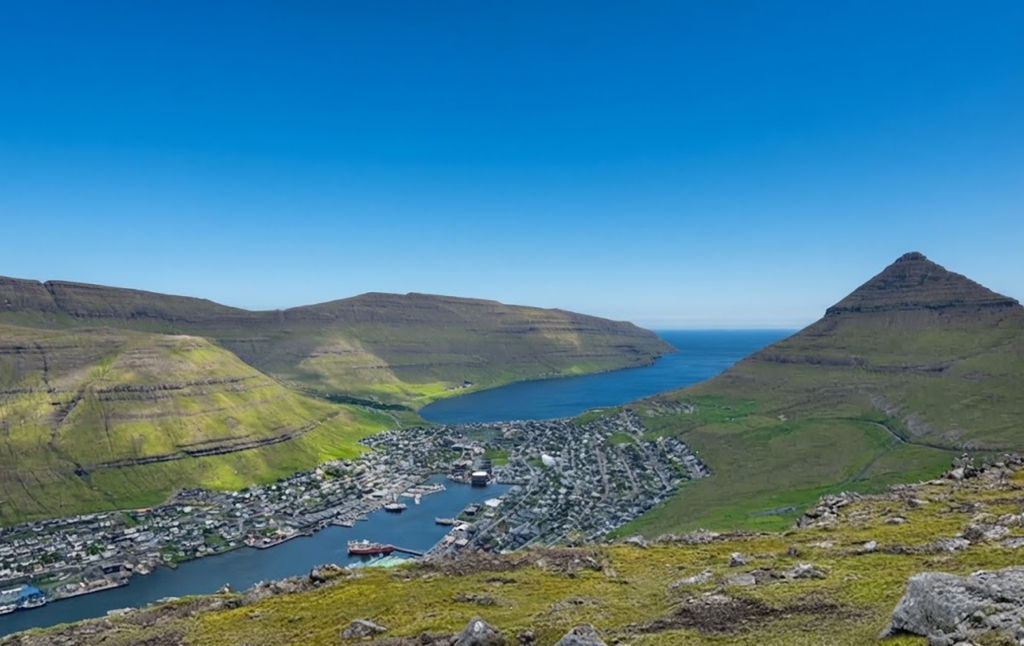
Klakkur is defined by its long, horizontal ridge. Walking north along its spine, you pass the transmitter mast and a red cottage. The views expand with each step. To the northwest, Kalsoy stretches like a sea serpent, its eastern coast dotted with settlements such as Syðradalur and Húsar. To the north, Kunoy’s Suður á Nakki rises like a seashell. To the south, Eysturoy extends toward Leirvík. The panorama is 360 degrees, encompassing fjords, islands, and sea.
The Summit – A Flat-Topped Panorama
Unlike sharp peaks, Klakkur’s summit is broad and flat. The entire ridge is essentially the top, though the best views are at the northern point. Here, the landscape feels mythic, shaped by fjords and light. The ridge itself is safe, but a narrow footpath descends further north. This section is semi-exposed and potentially dangerous, so most hikers return along the same route.

Practical Details
- Distance: 6.2 km out-and-back from the water tanks car park
- Elevation Gain: 277 meters
- Time Needed: Around 2 hours
- Difficulty: Easy to moderate
- Trailhead Elevation: 136 meters
- Summit Elevation: 413 meters
- Fee: None
The hike is free, and there are no facilities beyond Klaksvík. Bring food, water, and dress in layers. Weather in the Faroes is unpredictable, with sudden rain and strong winds. A rainproof jacket is essential.
Atmosphere – Light and Silence
Klakkur is especially rewarding in the evening. As the sun lowers, golden light bathes the islands, turning mountains into pyramids and fjords into mirrors. Winds often drop at dusk, leaving a silence that feels rare and restorative. Locals often hike here at sunset, sharing the view with loved ones. The name Ástarbreytin reflects this tradition: the path is a place for romance, reflection, and connection.
Photography – A Natural Studio
For landscape photographers, Klakkur is a dream. The ridge offers clear sightlines toward Kalsoy, Kunoy, and Eysturoy. The light changes rapidly, creating dramatic contrasts. Sheep often graze along the trail, adding pastoral elements to the composition. The best shots are taken in the evening, when the golden hour transforms the scene.
Combining Hikes – Klakkur and Kallur Lighthouse
With careful planning, it is possible to combine Klakkur with the Kallur Lighthouse hike on Kalsoy. The ferry from Klaksvík to Syðradalur connects directly to Kalsoy, and both hikes can be completed in a single day. Klakkur offers a ridge panorama, while Kallur provides a cliffside view of the lighthouse and surrounding sea. Together, they showcase the diversity of the Northern Isles.
Challenges – Mud, Wind, and Exposure
Though Klakkur is considered easy to moderate, there are challenges. The trail is muddy after rain, and the peat fields can be difficult to cross. Strong winds are common, especially on the ridge. The northern descent is narrow and semi-exposed, requiring caution. Waterproof boots and layered clothing are essential.

Local Culture – The Love Path Tradition
Ástarbreytin is more than a hiking route. It is part of local culture, a path where couples walk together. The name reflects this tradition, and many locals recommend the hike for romantic outings. The ridge itself feels intimate, a place where silence and scenery combine.
Extended Itineraries – Exploring the Northern Isles
Klaksvík is the best base for exploring the Northern Isles. In addition to Klakkur, visitors can hike to Villingardalsfjall on Viðoy or tackle the Árnafjørður – Toftaskarð – Katlarnir circuit trail. Ferries connect to Kalsoy, while road tunnels link Borðoy to Kunoy and Viðoy. Staying in Klaksvík for two nights allows time to explore multiple hikes.
Tórshavn – The Capital Connection
Tórshavn, located on Streymoy Island, is the capital of the Faroe Islands. Many travelers base themselves here, taking day trips to Saksun, Tjørnuvík, Vágar Island, and Eysturoy. From Tórshavn, ferries connect to Nólsoy, Sandoy, and Suðuroy. Klaksvík is reachable in 45 minutes by car, making Klakkur accessible even for those staying in the capital.

Seasonal Tips – When to Go
Klakkur can be hiked year-round, but conditions vary. Summer offers long daylight hours and milder weather. Winter brings snow and ice, making the trail more challenging. Spring and autumn are unpredictable, with rapid changes in weather. Evening hikes are especially rewarding in summer, when sunsets linger.
Effort and Reward
Klakkur is a hike that distills the essence of the Faroe Islands: modest effort, dramatic scenery, and a sense of connection. It is a ridge rather than a peak, a balcony rather than a summit. Yet the views are vast, encompassing islands, fjords, and sea. For those visiting Klaksvík, Klakkur is a priority. It is a walk that feels generous, offering grandeur in exchange for little effort.