
Appenzell > Things to do in Appenzell > Lisengrat Ridge
A Ridge Suspended Between Giants
There are places in the Alps where the mountains seem to conspire against human passage, where ridges rise so narrow and sheer that they appear to belong only to the sky. The Lisengrat Ridge is one of those places. It ties together two of Appenzell’s most commanding peaks—Mount Säntis, the highest at 2,502 meters, and Altmann, a proud spire at 2,435 meters.
Between them stretches a rocky spine, a path so slender that from the summit of Säntis it looks like a dare written in stone. And yet, thanks to ladders, staircases, and steel cables fixed into the rock more than a century ago, the dare becomes a trail, and the trail becomes one of Switzerland’s most spectacular hikes.
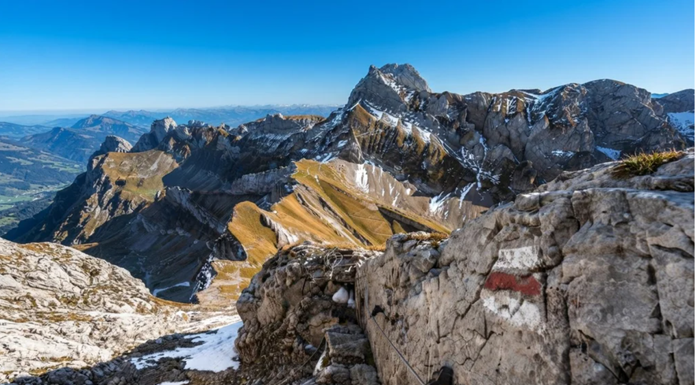
The Approach – Schwägalp and the Cable Car
Every journey to Lisengrat begins at Schwägalp Pass, a meadowed saddle where cowbells echo across green slopes and the scent of alpine grass drifts on the wind. From here, the Säntis Schwebebahn cable car lifts hikers into the sky. The ascent is swift—less than ten minutes—and yet it feels transformative.
Meadows give way to cliffs, forests to bare rock, until suddenly the cabin glides into cloud. On clear days, the ride is a revelation: six countries visible from the summit, the Alps unfurling in every direction. On cloudy days, it is a plunge into mystery, the mountain wrapped in silence and mist.
The First Glimpse of the Ridge
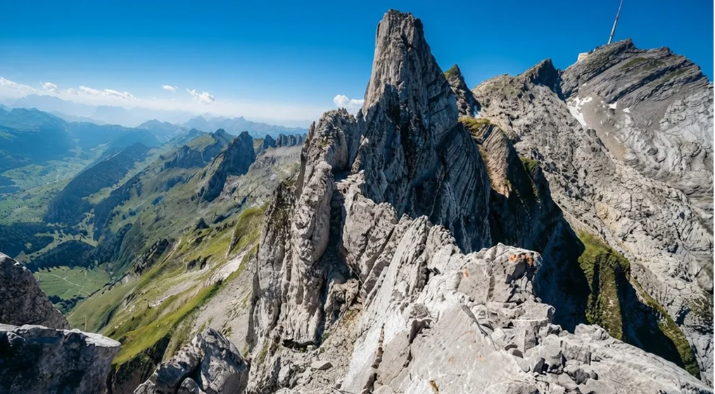
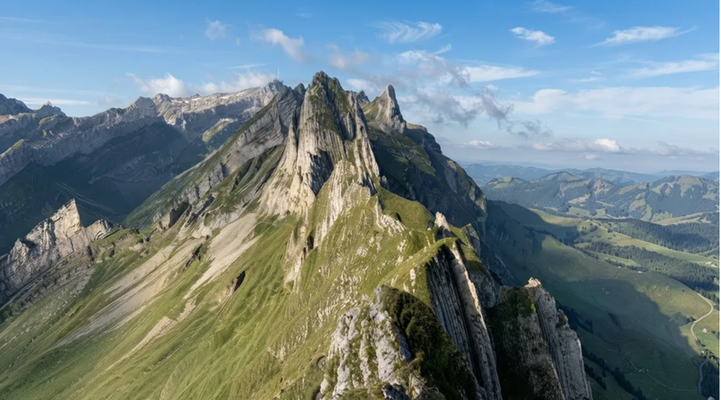
At the summit station, the world feels both vast and precarious. Terraces look out across the Alpstein massif, and there, to the east, lies the Lisengrat. It is a line of stone, narrow and jagged, running like a scar between Säntis and Altmann. At first glance, it seems impossible.
How could anyone walk that knife-edge safely? But then the eye catches the glint of steel cables, the outline of ladders, the faint trace of a path. The impossible becomes improbable, and the improbable becomes irresistible.
A Trail of History
The Lisengrat is not a modern invention. In 1905, the Swiss Alpine Club installed the first chains and steps to make the ridge traversable. Restored in 2010, the route remains a living monument to alpine audacity. Each rung of the ladder, each cable fixed into stone, is a reminder of those who believed that even the most precarious ridges could be crossed.
Hiking Lisengrat is not just a physical journey; it is a step into history, a continuation of a century-old tradition of mountain daring.
The Character of the Trail
Marked white-red-white, Switzerland’s designation for “moderate” mountain hikes, the Lisengrat is moderate only in classification. Its difficulty lies not in endless kilometers or punishing elevation gain, but in the terrain itself. Ledges no wider than a boot, staircases clinging to cliffs, airy traverses where the abyss yawns on either side.
Yet there is reassurance too. Every exposed section is secured with fixed cables. There is always something to hold, always a safeguard against the void. It is not reckless adventure, but carefully managed exhilaration.
Clouds and Clarity
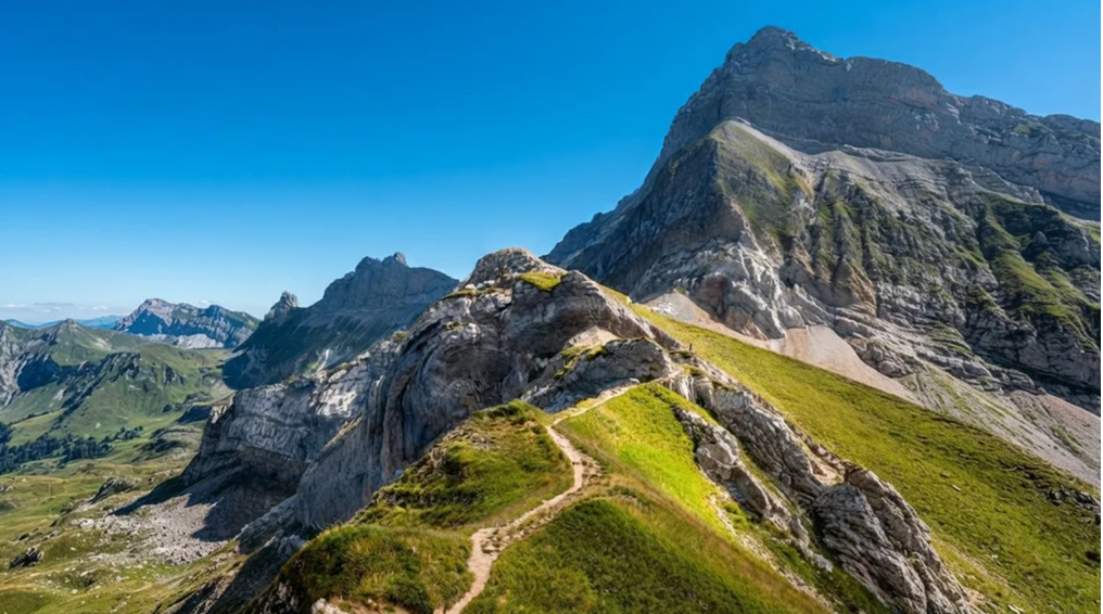
Weather defines the Lisengrat experience. On cloudy days, the ridge is a ghostly silhouette, the world beyond hidden in mist. Steps feel tentative, the abyss invisible but imagined. On clear days, the ridge is a balcony over the Alps, every step rewarded with a panorama that stretches from Lake Constance to the distant Bernese Oberland.
Clouds may gather, storms may brew, but when the sky opens, the world unfurls in a 360° sweep of peaks, valleys, and shimmering lakes. It is a view that silences words, leaving only awe.
The Flora and Fauna of the Ridge
Though the Lisengrat is a place of rock and exposure, life clings to its edges. Alpine flowers bloom in cracks—edelweiss, gentian, alpine roses—delicate bursts of color against gray stone. Chamois move across slopes with effortless grace, their silhouettes sharp against the sky.
Marmots whistle from hidden burrows, unseen but ever-present. To walk the Lisengrat is to walk not only among stone and sky, but among the quiet persistence of alpine life.
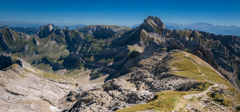
The Descent to Rotsteinpass
The ridge leads eastward, descending toward Rotsteinpass, a mountain pass where a hut offers shelter and rest. Here, hikers can pause, sip coffee, and look back at the ridge they have crossed. From Rotstein, the trail can extend further—toward the Fliswand wall, even up to the summit of Altmann.
But for many, the ridge itself is enough. To cross Lisengrat is to complete a journey that feels both daring and complete.
Practical Notes
Distance: 5.1 km out-and-back
Time Needed: 2.5–3.5 hours, depending on pace and conditions
Elevation Gain/Loss: Around 400 meters
Difficulty: Moderate to hard – technical, exposed, not suitable for children or those with vertigo
Season: Best from June to September, when snow has melted and the ridge is dry
Access: Begin at the summit of Säntis, reached via cable car from Schwägalp (note: closed May–Autumn 2026 for renovations, reopening spring 2027)
Trail Map: K+F 09, Appenzell, Säntis, St. Gallen 1:40,000
A Word of Caution
This is not a trail for rain, nor for snow. Wet rock and narrow ledges turn adventure into danger. The Lisengrat demands respect: respect for weather, respect for altitude, respect for the mountain itself. Attempt it only in dry, clear conditions, when the ridge is not a threat but a promise.
The Essence of Lisengrat
To walk the Lisengrat Ridge is to step into a story of alpine audacity. It is not the longest hike, nor the hardest, but it is among the most unforgettable. Each ladder climbed, each cable held, each cautious step across the ridge is rewarded with the sensation of walking on the very edge of the sky.
For those who dare, the Lisengrat is not just a trail—it is a memory carved into stone and cloud, a reminder that sometimes the most spectacular paths are the ones that ask us to trust our footing, steady our breath, and look out across the world with wonder.