
Gateway to Madrid’s Wilderness
Barely an hour’s drive from the center of Madrid, the Sierra de Guadarrama National Park opens like a vast wilderness frontier. Declared a national park in 2013, it covers 34,000 hectares of granite peaks, alpine meadows, and dense forests. For visitors, it is a sudden shift from the city’s rhythm to a landscape of silence, streams, waterfalls, and snowbound ridges. The park is not simply a scenic escape; it is a living ecosystem where endemic species, geological formations, and cultural heritage converge.
At its highest point rises Peñalara Peak, standing at 2,428 meters. From here, the panorama stretches across valleys, ridges, and forests that define the park’s essence. The peak is more than a viewpoint; it is a geological and biological landmark, shaped by glacial origins and surrounded by alpine grasslands.
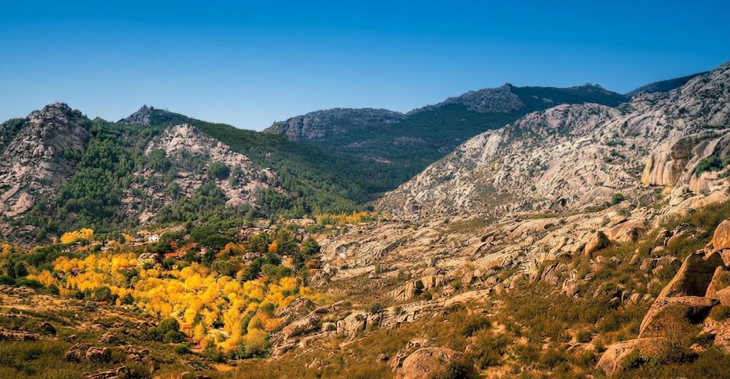
The Landscape of Granite and Forest
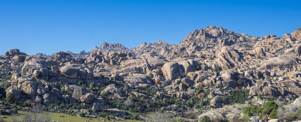
The Sierra de Guadarrama forms part of the Sistema Central, a mountain chain dividing Madrid from Castilla y León. Its granite formations dominate the skyline, while cols and ridges rise above 2,000 meters. Among them are Camino del Nevero, Cuerda Larga, Sierra de la Morcuera, Siete Picos, La Pedriza, and Peña del Oso. Each range carries its own character: snow-capped in winter, green with pine and oak in summer.
Below these peaks lie forests of wild pine and Pyrenean oak, alpine grasslands, and seasonal streams. The ecological balance here is delicate yet resilient, with flora such as wild broom and creeping juniper shaping the terrain. The park is also home to 43 monumental trees, some over a century old, ten of which stand within its boundaries.
Wildlife and Birdlife
The Sierra de Guadarrama is a sanctuary for wildlife, holding nearly half of Spain’s species. Mammals include fallow deer, wild boar, Spanish ibex, and the Iberian wolf, whose population has been steadily increasing. Birdlife is equally rich, with sightings of black vultures, golden eagles, Iberian imperial eagles, alpine accentors, bee-eaters, and barn owls. The skies above the ridges are alive with raptors, while the valleys echo with the calls of smaller birds.
This biodiversity is not incidental; it is the result of centuries of ecological balance. The park’s varied altitudes and habitats create niches for species that thrive in both alpine and Mediterranean conditions.
Activities for Every Season
Adventure defines the park. In summer, cycling, canyoning, horse riding, and zip lining fill the valleys. Hiking trails range from gentle walks to demanding ascents, best enjoyed between May and October. In winter, snow transforms the peaks into playgrounds for skiing and snowboarding, with Valdesquí and Puerto de Navacerrada as the most popular slopes.
Swimming adds another dimension. Natural pools such as Las Presillas and Cercedilla offer summer relief, turning the park into a recreational getaway for families.
Hiking the Trails
Hiking is the park’s most immersive experience. Trails weave through forests, climb ridges, and cross valleys, offering perspectives that shift with altitude. Beginners can enjoy gentle paths near Rascafría, while advanced hikers tackle the demanding ascents of Cuerda Larga or La Maliciosa.
Warm weather enhances the experience, with alpine meadows in bloom and streams flowing freely. Winter hikes are less accessible, as snow and cold limit enjoyment, but they reveal a stark beauty in frozen landscapes.
1) Hiking Rascafría Difficulty
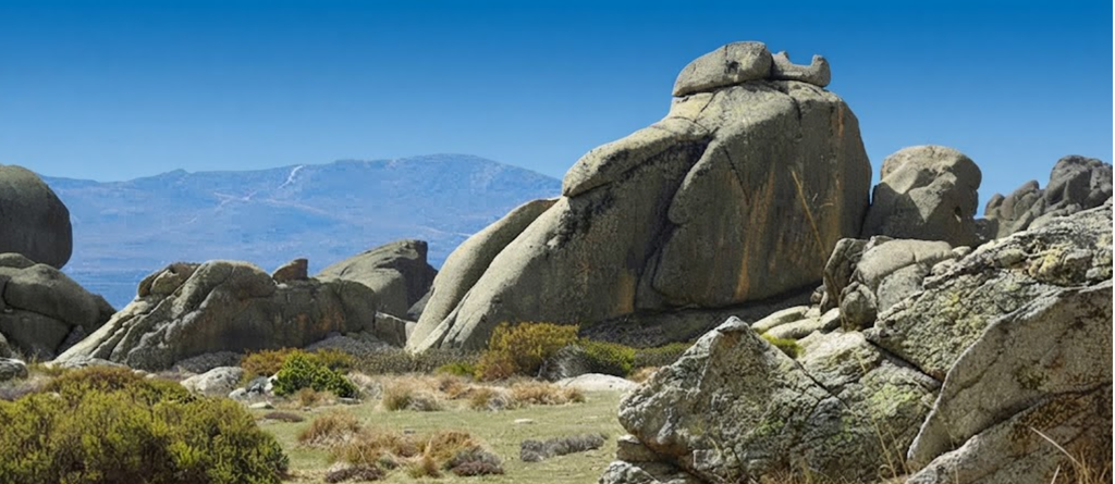
Nestled in the Sierra de Guadarrama, the village of Rascafría is more than a mountain retreat. It is a gateway into landscapes that shift from shaded pine forests to granite ridges, offering trails that range from gentle strolls to demanding ascents.
Understanding the Terrain
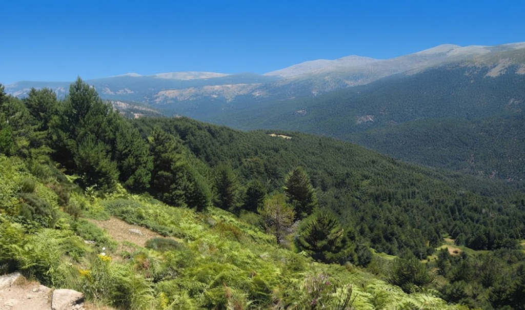
The Sierra de Guadarrama defines the hiking experience around Rascafría. Trails weave through river valleys, climb toward alpine meadows, and rise into rocky summits. Elevation changes are constant, and the terrain alternates between soft forest soil and uneven granite. This variety is what makes the area so appealing: every trail feels distinct, and difficulty depends as much on the surface underfoot as on the altitude gained.
At lower elevations, the Lozoya Valley offers shaded paths along streams and meadows. Higher up, routes toward Peñalara Peak demand stamina, rewarding hikers with sweeping views across Madrid’s northern frontier.
Low to Moderate Difficulty Trails
For those seeking a relaxed day outdoors, Rascafría’s easier trails provide accessible beauty. Paths like the Camino Natural del Valle del Lozoya follow gentle inclines, often tracing rivers or crossing open fields. Families, casual walkers, and day trippers find these routes ideal: shaded, well-marked, and rich with birdlife.
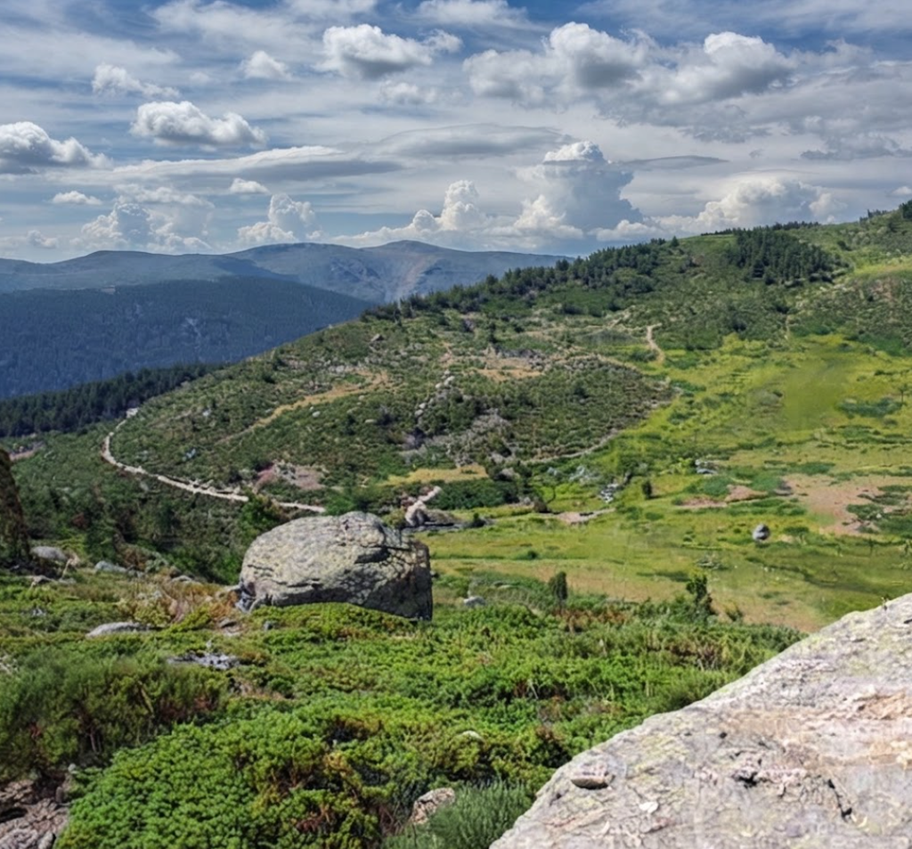
The Las Presillas natural pools are a favorite destination, combining a short walk with the reward of swimming in clear mountain water. These trails rarely exceed three hours and allow hikers to enjoy the scenery without strenuous effort.
High Difficulty Trails
Experienced hikers gravitate toward the demanding climbs. The ascent to Peñalara, at 2,428 meters, is the crown jewel. The trail begins gently but soon steepens, crossing rocky sections and exposed ridges. Weather shifts quickly at this altitude, and preparation is essential: sturdy boots, layered clothing, and navigation tools.
Other challenging routes include the Cuerda Larga ridge, a high-altitude traverse linking multiple peaks, and the rugged paths of La Pedriza, Europe’s largest granite outcrop. These hikes demand endurance but reward with panoramic views and a sense of wilderness rarely found so close to Madrid.
Choosing the Right Trail
Selecting a route depends on time, fitness, and intent. Shorter trails near the village are perfect for half-day escapes, while summit routes require a full day and strong conditioning. Trail maps are available at local visitor centers, and checking the weather forecast is crucial. Summer afternoons can be hot, while sudden storms may sweep across the peaks.
Essential Hiking Tips
- Footwear: Sturdy shoes with grip are vital, especially on granite.
- Hydration: Carry more water than you expect; mountain streams are not always reliable.
- Timing: Start early to avoid midday heat and to enjoy quieter trails.
- Navigation: While most routes are marked, tougher trails benefit from GPS or a detailed map.
- Respect: Stay on paths to protect fragile ecosystems and ensure safety.
Facilities Without Overnight Stay
Not every hiker wants to book a lodge. After a hike, you can unwind in a pool, enjoy a gourmet meal, or relax in a sauna before returning to Madrid. It transforms a hiking day into a balanced retreat.
Frequently Asked Questions
- Beginner Difficulty: Gentle trails along rivers and meadows make Rascafría accessible for newcomers.
- Gear for Tough Hikes: Boots with ankle support, layered clothing, maps, and energy-rich snacks are essential.
- Day Access: Yes, day passes are available for pools, spas, and restaurants near the trails.
- Trail Markings: Most popular routes are well marked, though summit trails require careful navigation.
2) Cuerda Larga: Hiking Madrid’s High Ridge
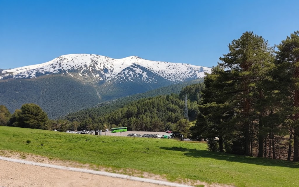
The Cuerda Larga is one of the most iconic traverses in the Sierra de Guadarrama, stretching for 15.5 kilometers along a granite and gneiss ridge between Puerto de Navacerrada and Puerto de la Morcuera. It is a route that defines the high range of Madrid’s mountains, a classic alongside the famed Travesía Dos Castillas. For hikers, it is both a challenge and a reward: a long, exposed ridge walk with sweeping views across valleys, peaks, and plains.
The Ridge Between Two Provinces
Cuerda Larga runs northeastward, straddling the boundary between Madrid and Segovia. To the south, granite dominates the landscape, while to the north, gneiss shapes the terrain. This geological contrast is visible from the ridge itself, where the textures of rock shift with each step. The views are expansive: to the south, the pine forests of the Lozoya Valley; to the north, the rugged slopes descending toward Segovia.
The ridge is not a place of shelter. It is exposed, open, and unforgiving in poor weather. Yet in good conditions, it offers one of the most exhilarating hikes in central Spain.
When to Attempt Cuerda Larga
Timing is everything. The ridge should be avoided in the hottest months of July and August. With no shade and no water sources, the heat becomes punishing. In winter, fog can roll across the ridge, erasing landmarks and making navigation treacherous. The safest seasons are spring and autumn, when temperatures are moderate and visibility is clearer.
Even then, hikers must start early. Short days in late autumn and winter demand morning departures to ensure enough daylight for the full traverse.
Approaches and Logistics
Most hikers begin at Puerto de Navacerrada, climbing onto the ridge before following it northeast to Puerto de la Morcuera. Because the route is linear, logistics require planning. One option is to arrange transport: a companion drives to Morcuera to collect you after the hike. Another is to descend from the ridge into Miraflores de la Sierra, where buses connect back to Madrid.
Public transport is possible, with trains and buses reaching Puerto de Navacerrada. From there, the ridge unfolds as a full-day adventure.
Weather and Hazards
The ridge’s exposure makes weather the defining factor. In summer, sunstroke and dehydration are real risks. In winter, fog and snow complicate navigation. Sudden storms can sweep across the peaks at any time of year.
Because there are few reference points along the ridge, mist can disorient even experienced hikers. Carrying a map, compass, and GPS is essential.
Gear and Preparation
Preparation for Cuerda Larga depends on the season:
- Summer essentials: cap, sunscreen applied multiple times, and at least 1.5 liters of extra water per person.
- Autumn and winter gear: warm clothing, hard-shell jacket, compass, altimeter, GPS, gaiters, crampons, and ice axe.
- Year-round basics: sturdy trousers, trekking poles, and layered clothing for sudden weather changes.
Water is the most critical resource. There are no reliable sources along the ridge, so hikers must carry all they need.
The Experience of the Traverse
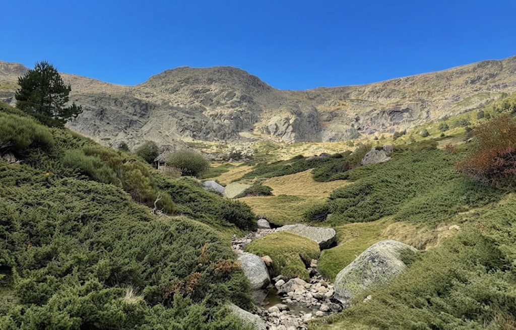
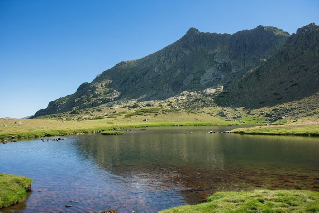
Walking Cuerda Larga is a test of endurance. The ridge maintains a high altitude, often above 2,000 meters, with constant ascents and descents across peaks. Each summit reveals new perspectives: the granite towers of La Maliciosa, the rolling ridges of Cabeza de Hierro Mayor, and the distant plains stretching toward Madrid.
The sense of exposure is constant. With no forest cover, the sky dominates the experience. On clear days, the horizon seems endless, and the ridge feels like a pathway suspended between provinces.
Practical Advice
- Begin at dawn to maximize daylight.
- Inform someone of your route and expected finish time.
- Carry more water than you think necessary.
- Respect the ridge’s exposure: turn back if weather deteriorates.
- Plan transport in advance to avoid being stranded.
A Classic of Guadarrama
Cuerda Larga is not just a hike; it is a rite of passage for those exploring Madrid’s mountains. Its length, exposure, and altitude make it demanding, but its views and geology make it unforgettable. It is a route that requires respect, preparation, and endurance, but for those who complete it, the reward is a panorama of Spain’s central mountains that lingers long after the hike ends.
Eight Landmarks to Discover
The park’s geography is defined by landmarks that carry both natural and cultural significance.
Puerto de Navafría sits at 1,773 meters, a pine-clad pass leading to The Nevero peak. It is also home to a cross-country ski resort.
Reajo Alto, at 2,099 meters, divides the Lozoya and Navafría valleys. Its slopes are adorned with pine forests and mountain shrubs.
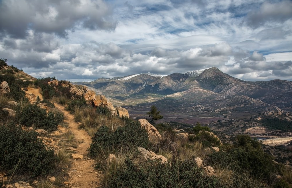
Cuerda Larga stretches with an almost constant altitude above 2,100 meters, crowned by Cabeza de Hierro Mayor at 2,383 meters.
Sierra de la Morcuera spans 58 kilometers, linking valleys and ridges, with La Najarra peak at 2,108 meters.
Siete Picos, shaped like a dragon’s spine, is iconic among hikers, its seven granite peaks rising above forests.
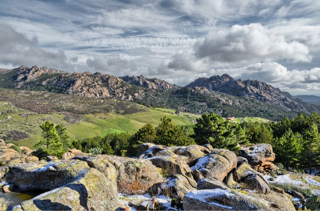
Sierra de los Porrones includes La Maliciosa peak at 2,227 meters, with trails that challenge climbers.
Peña del Oso stands at 2,196 meters, marked by a granite sculpture resembling a bear.
La Pedriza is Europe’s largest granite range, a playground for climbers with eroded outcrops forming boulder fields.
Each landmark offers a different perspective on the park’s geology and ecology, making exploration a layered experience.
Practical Information
The park is open daily from 8 AM to 6 PM. The best time to visit is between May and October, when trails are accessible and weather is favorable. Tickets start at €149, with guided tours available for hiking, rock climbing, and wildlife spotting.
The suggested duration is at least three and a half hours, though two to three days allow for deeper exploration. The park’s address is 28741 Rascafría, Madrid, Spain, easily reached by car or public transport.
A Wilderness Frontier
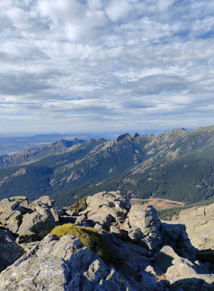
The Sierra de Guadarrama is more than a national park; it is Madrid’s wilderness frontier. Its granite ridges, alpine forests, and snowbound peaks create a landscape where nature thrives close to the city. For visitors, it is a place to reconnect with the wild, to hike, to ski, to swim, and to witness the balance of ecosystems that define Spain’s natural heritage.
This is not simply a destination; it is an experience of scale, silence, and biodiversity. The Sierra de Guadarrama reminds us that wilderness is never far from civilization, and that within an hour of Madrid lies a world where wolves roam, eagles soar, and granite ridges rise against the sky.