
5 Days Across Wilderness and Wonder
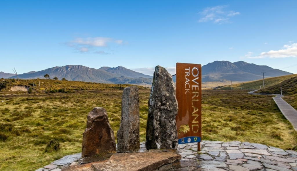
Tasmania’s Overland Track is not simply a hike—it is a journey through the beating heart of wilderness, a trail that threads together jagged dolerite peaks, alpine tundra swept by wind, rainforests fragrant with moss and myrtle, and waterfalls that tumble in silver cascades into deep valleys. Each year, more than 8,000 walkers—locals, mainland Australians, and international adventurers—lace their boots at Ronny Creek and set out across Cradle Mountain-Lake St Clair National Park, following this 70km passage south to Cynthia Bay.
It is a walk that feels immense in its scenery yet intimate in its rhythm. Immense, because mountains rise like fortresses above buttongrass plains and lakes shimmer beneath skies that change in an instant. Intimate, because each day carries you only 2.5 to 5 hours along the trail, a pace that allows beginners to discover bushwalking without fear and veterans to savour the landscape without hurry.
Preparing for the Journey

Passes and Permits
From 1 October to 31 May, the Overland Track operates under a booking system. Only 34 independent walkers are permitted to begin each day, ensuring the wilderness remains preserved and the huts uncrowded. Bookings open on 1 July, and demand is fierce—especially for summer departures. The fee is $200 per person, granting access to the track but not to the huts themselves, since hut reservations are not possible.
Outside the booking season, from June to September, no Overland Track pass is required, though a National Parks Pass is still essential. Winter walking offers solitude and beauty, but also unpredictability: snow, sleet, and sudden storms can transform the trail into a test of resilience.
National Parks Pass
Every walker must carry a National Parks Pass, available online or at the Cradle Mountain Visitor Centre. This pass includes shuttle bus access to the trailhead at Ronny Creek.
Check-In
Before stepping onto the track, you must check in at the Visitor Centre. Rangers confirm your passes, sight your gear, and ask you to complete a safety checklist. Even if you plan to sleep in huts every night, you are required to carry a tent—because in Tasmania, weather and circumstance can change in an instant. You’ll also receive Overland Track tags to attach to your pack, marking you as part of the journey.
At each hut, you’ll sign into a registry, noting your intended destination and overnight stop. This simple act of writing your name into the book is more than bureaucracy—it is a thread of connection, a way for rangers to trace your steps should the wilderness turn against you.
The 5-Day Itinerary
Day 1: Ronny Creek to Waterfall Valley
- Distance: 10.7km + 2km return ascent of Cradle Mountain
- Trail hours: 3.5hrs + 2hrs for Cradle Mountain
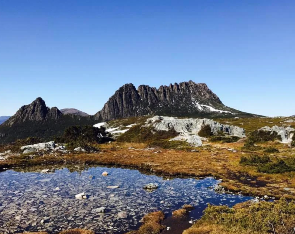
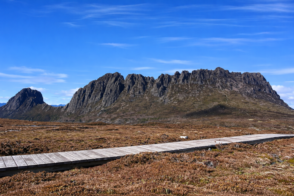
- Highlights: Crater Lake’s still waters, Marion’s Lookout at 1250m, and the jagged summit of Cradle Mountain
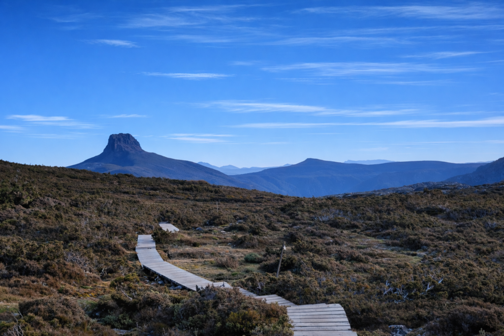
The trail begins gently, winding past boardwalks and alpine tarns, before climbing steeply to Marion’s Lookout. From here, Cradle Mountain rises in sharp relief, its dolerite columns catching the light. Many walkers choose to ascend the peak, a challenging but unforgettable detour. The day ends in Waterfall Valley, where the hut sits beneath the looming presence of Barn Bluff.
Day 2: Waterfall Valley to Windermere
- Distance: 7.8km + 3km return to Lake Will
- Trail hours: 2.5hrs + 1hr to Lake Will
- Highlights: Barn Bluff views, wildflower meadows, sparkling mountain lakes
The descent into Waterfall Valley gives way to rolling terrain, dotted with alpine lakes. Lake Will, reached via a short side trip, is a place of quiet reflection, its waters framed by dolerite cliffs. Windermere Hut offers shelter amid buttongrass plains, where sunsets paint the sky in hues of gold and violet.
Day 3: Windermere to Pelion
- Distance: 16.8km
- Trail hours: 4.5hrs
- Highlights: Forth Valley vistas, rainforest shade, Mt Oakleigh’s spires
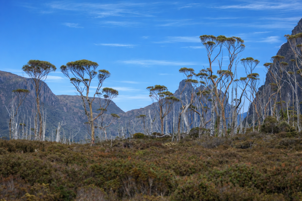
This is the longest day, but also one of the most varied. The trail passes through myrtle-beech rainforest, where the air is cool and damp, before opening onto expansive moorlands. Old Pelion Hut offers a swimming spot, while the newer Pelion Hut sits beneath Mt Oakleigh, its dolerite spires rising like cathedral towers.
Day 4: Pelion to Kia Ora
- Distance: 8.6km + 5.2km return ascent of Mt Ossa
- Trail hours: 3hrs + 3.5hrs for Mt Ossa
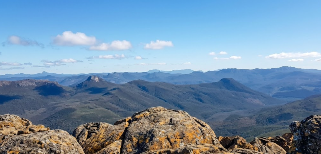
- Highlights: Mt Ossa summit, Pinestone Valley views, waterfalls near Kia Ora
This day carries you into the heart of Tasmania’s mountains. The optional ascent of Mt Ossa, at 1617m, is the highest point in the state. From its summit, the world unfolds in every direction—valleys, peaks, and distant horizons. Kia Ora Hut lies beside a creek, its waters tumbling in small cascades that lull walkers to sleep.
Day 5: Kia Ora to Windy Ridge
- Distance: 9.6km + 1.5km return to Hartnett Falls
- Trail hours: 3.5hrs + 1hr for Hartnett Falls
- Highlights: Hartnett Falls, eucalypt forest, Bert Nichols Hut
The trail meanders through forest, shaded and fragrant, before reaching Hartnett Falls. Here, water plunges into a deep gorge, its roar echoing through the valley. Bert Nichols Hut, the largest on the track, offers sweeping views of the surrounding mountains.
Day 6: Windy Ridge to Narcissus
- Distance: 9km
- Trail hours: 3hrs
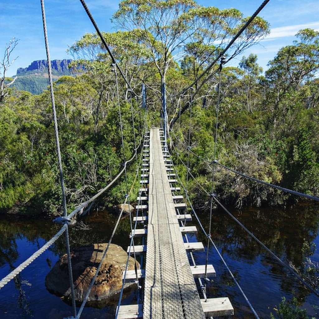
- Highlights: Suspension bridge crossing, Narcissus River swim, ferry across Lake St Clair
The final day is gentler, carrying you across the track’s only suspension bridge and along the Narcissus River. Many walkers end with a swim, plunging into the cool waters before boarding the ferry across Lake St Clair—the deepest natural lake in Australia.
What to Expect on the Trail
Terrain
The Overland Track is well-graded, with boardwalks covering around 40% of the route. These raised paths protect fragile ecosystems and offer easy walking, though side trips to peaks and waterfalls are more rugged. The final section near Narcissus is root-strewn and rocky, demanding attention with every step. Trekking poles and sturdy boots prove invaluable here.
Water
Each hut has rainwater tanks, providing potable water. Official advice is to filter, though many walkers drink directly without issue. Streams and tarns along the way can also be used, though in summer they may dry out. Carry enough water to be self-sufficient, and filter stagnant sources if needed.
Huts & Camping
There are six huts along the track, each with its own character. Some are small and intimate, others spacious and communal, but all provide bunks, tables, and cooking areas. Tent platforms and open sites surround the huts, offering options for those who prefer solitude or arrive after huts are full. Nights here are a blend of camaraderie and quiet reflection—stories shared over stoves, boots drying by heaters, stars wheeling above the plains.
Is the Overland Track for You?
This walk is suitable for anyone able to carry a 15–25kg pack, manage short steep sections, and walk 2.5–5 hours per day. You’ll need appropriate gear—tent, sleeping bag, rain jacket, warm clothing, sturdy boots—and a basic knowledge of first aid. With preparation, the Overland Track is safe, rewarding, and unforgettable.
The Overland Track is not just a hike; it is a journey through Tasmania’s soul. It is the rhythm of footsteps across boardwalks, the silence of alpine lakes, the roar of waterfalls, and the camaraderie of huts filled with weary, joyful walkers. It is the knowledge that in six days you have crossed a wilderness, carrying everything you need on your back, and finding in the process both challenge and serenity.
For some, it is an introduction to bushwalking. For others, it is a pilgrimage. For all, it is a reminder that the world still holds places where nature reigns, where mountains rise unbroken, and where the simple act of walking can feel like a revelation.