
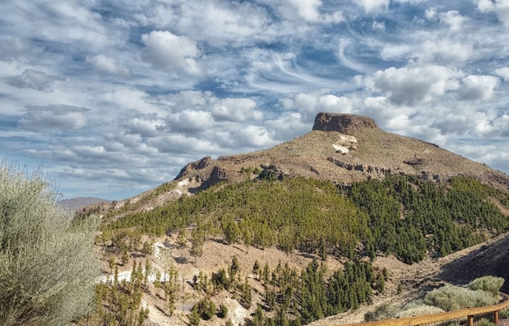
Declared a national park in 1954 and inscribed as a World Heritage Site in 2007, Teide National Park is the Canary Islands’ most celebrated natural landmark. Rising 3,718 metres above sea level, Mount Teide is Spain’s highest peak and the third‑largest volcanic structure in the world. Its vast wilderness of lava flows, lunar valleys, and twisted rock formations covers nearly 19,000 hectares, a landscape that feels closer to Mars than Earth.
First Impressions
Arriving in Teide National Park is an experience of silence and scale. The colours shift from ochre to black, the textures from smooth pumice to jagged basalt. Air thins with altitude, and every turn reveals a new geological theatre. This is the spiritual and geographical epicentre of Tenerife, a place where nature’s power is written across the land.
Approaching Teide
All roads in Tenerife lead to Teide, but each approach offers a different character.
- The TF‑21 from Los Cristianos climbs through cinematic volcanic scenery.
- The TF‑38 from Los Gigantes skirts dramatic cliffs before curving inland.
- From La Orotava in the north, the TF‑21 becomes a picturesque ascent through terraced valleys.
- The TF‑24 from La Esperanza is perhaps the most enchanting, winding through misty forests before breaking into a sea of clouds created by trade winds.
For those without a car, TITSA buses — line 342 from Playa de las Américas and line 348 from Puerto de la Cruz — connect visitors to the park. The routes are winding, so travellers prone to motion sickness should prepare accordingly.
Guided Excursions
Exploring with a professional guide adds depth. Options range from half‑day hikes to sunset‑and‑stars tours. Luxury hotels such as the Royal Hideaway Corales Resort even arrange bespoke private trips. Guides provide geological context, cultural history, and safe navigation through the park’s most dramatic terrain.
Mount Teide and Its Companions
The park’s protagonist is Mount Teide itself, a volcano formed around 600,000 years ago. From its summit, the silhouettes of other Canary Islands are visible on clear days. Surrounding features include the vast Las Cañadas caldera, Montaña Blanca, and Pico Viejo. Together they form a volcanic amphitheatre that defines Tenerife’s skyline.
Flora and Fauna
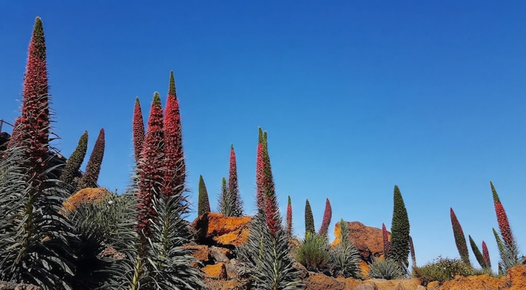
Despite the altitude, 139 plant species survive here. The most striking is the red bugloss, a crimson spike reaching three metres, serving as the park’s emblem. The Guanches once used its roots for dyeing hides. Only three tree species thrive — Canary Islands juniper, pine, and willow — standing in stark contrast against black lava fields. Wildlife includes lizards, kestrels, and endemic invertebrates adapted to the volcanic terrain.
Hiking Routes
Teide offers more than its summit. Over 40 marked trails reveal different aspects of the park.
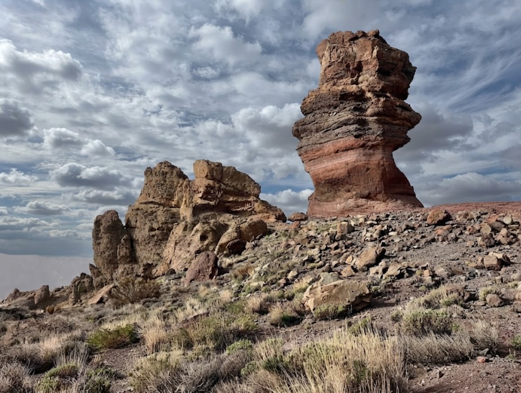
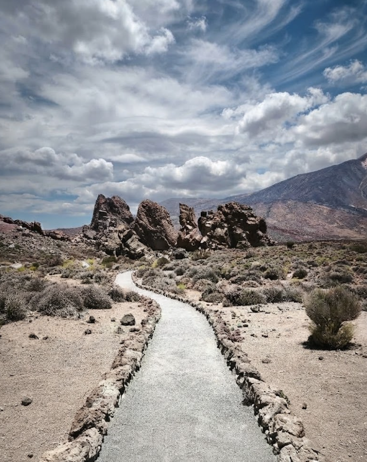
- Roques de García: A two‑hour circular walk among surreal rock formations, including the famous Roque Cinchado. Views are staggering, especially in spring when scarlet Tajinaste blooms.
Roques de García – Easy Loop in Teide National Park
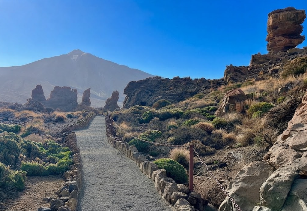
In the centre of Teide National Park, the Roques de García loop offers one of Tenerife’s most approachable yet visually spectacular hikes. This short circuit is celebrated for its surreal volcanic formations, shapes so improbable they appear sculpted by another planet. It is a trail that condenses the drama of Teide into a manageable walk, perfect for travellers who want a genuine encounter with the park without committing to a full day’s climb.
Setting the Scene
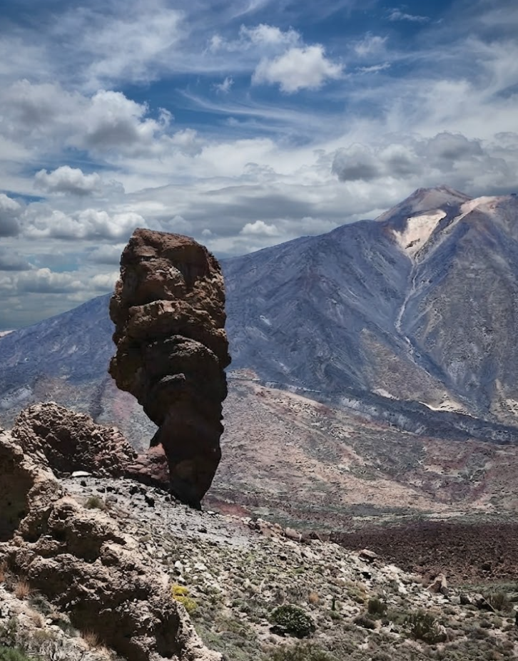
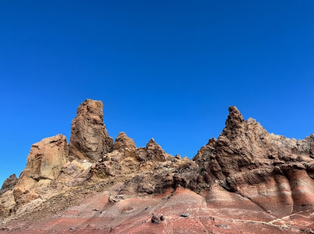
The trail begins beside the Parador de Las Cañadas del Teide, perched at 2,151 metres. From the very first steps, the landscape feels cinematic. Hardened lava stretches across the plateau, while jagged monoliths rise against the skyline. Within minutes, hikers stand beneath Roque Cinchado, the “Finger of God,” a precarious column that has become an emblem of Tenerife. Its silhouette, once printed on Spain’s 1,000‑peseta note, is a reminder of how geology can become cultural iconography.
The Loop Experience
Walking the loop is less about endurance and more about immersion. The path is well‑maintained, winding across volcanic terrain that alternates between rocky sections and open exposure. About ten minutes in, the trail reaches a small col where Teide itself dominates the horizon. This is the moment the park opens up, revealing the scale of the caldera and the distant ridges that frame the island.
Soon after, a junction appears where a branch leads toward Pico Viejo. Staying on the main loop, the terrain shifts into hardened lava fields. A small plateau offers a natural pause, a place to absorb the views before descending into a shallow valley. Here, the rock formations gather in exaggerated shapes, balanced in ways that defy logic. Some resemble towers, others arches, all sculpted by centuries of erosion.
Many hikers take short detours, scrambling onto low rocks for closer inspection. These diversions are not technical, but they heighten the sense of exploration. The loop concludes with a modest climb of around 100 metres back toward the starting area. It is the only section where effort is felt, but it is brief and manageable, leaving most visitors with energy to spare.
Practical Notes
The loop measures 4.5 kilometres, with an elevation gain of 200 metres. Most complete it in one to two hours. Difficulty is rated easy, making it accessible to families, casual walkers, and those unaccustomed to high‑altitude hiking. The trail is open year‑round, though early mornings and cooler months are best to avoid heat and crowds.
There are no water refill points along the route, so carrying sufficient supplies is essential. Footwear can be simple — sturdy trainers or trail shoes suffice — but sun protection is non‑negotiable. The volcanic plateau offers little shade, and exposure is constant.
Getting There
Parking near the Parador is limited and fills quickly. Arriving early or late in the afternoon reduces stress, though overflow parking is often found along the TF‑21 road. For those travelling by bus, TITSA line 348 connects Puerto de la Cruz and La Orotava with the park, stopping near the trailhead. Schedules vary, so checking in advance is recommended.
Why Roques de García Matters
Roques de García distils the essence of Teide into a compact experience. It is short, accessible, and visually spectacular, offering a genuine sense of the park’s volcanic drama without requiring a full‑day commitment. For travellers with limited time, it is the perfect introduction to Tenerife’s volcanic heart.
The formations themselves are more than geological curiosities. They are symbols of resilience, shaped by eruptions and erosion into forms that seem almost deliberate. Walking among them is a reminder of the forces that created Tenerife, forces that continue to shape its identity.
A Trail for All
Unlike the demanding ascent to Teide’s summit, Roques de García is a trail that welcomes almost anyone. Families with children, casual walkers, and seasoned hikers alike find satisfaction here. It is a democratic path, offering grandeur without exclusion.
The loop also serves as a gateway. For some, it is a first taste of Teide, sparking curiosity to explore further. For others, it is a final stop, a way to absorb the park’s essence without venturing into more strenuous terrain. In either case, it delivers a complete experience in miniature.
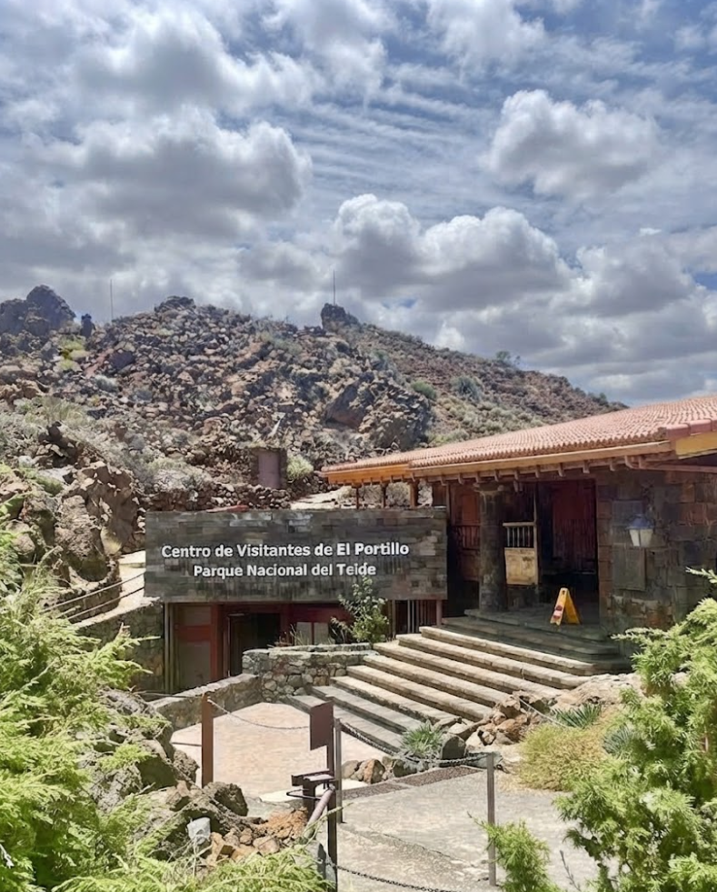
- Arenas Negras: A gentle loop from El Portillo Visitor Centre through golden broom fields into volcanic earth, ending with sweeping views of gorges and cloud seas.
Montaña de las Arenas Negras
The Montaña de las Arenas Negras hike is one of the most contemplative circular routes in Teide National Park. Starting at the El Portillo Visitor Centre, this trail combines volcanic drama, sweeping panoramas, and encounters with endemic flora and fauna. It is a route that balances accessibility with challenge, offering intermediate difficulty across 7.5 kilometres, with elevation gains and losses that test but do not overwhelm.
The Ascent along Montaña del Cerrillar
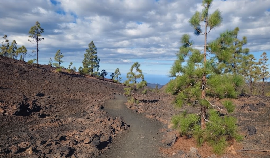
The hike begins with a steady climb bordering Montaña del Cerrillar. Here, the slopes are carpeted with Teide white broom (Spartocytisus supranubius), shrubs that root themselves in pumice and bloom spectacularly in spring. Their white blossoms create a striking contrast against the black volcanic soil, transforming the mountainside into a living canvas. The ascent is gradual, allowing walkers to adjust to altitude while absorbing the silence of the high plateau.
Panoramic Views from the Ridge
At 2,304 metres, the trail reaches its highest point. From here, the panorama is breathtaking. The Llano de Maja plain stretches below, framed by ridges and lava flows. To the north, the Orotava Valley is often covered by a sea of clouds, formed by trade winds pushing moisture upward. This phenomenon creates a rolling blanket of white that contrasts with the volcanic terrain above. On clear days, the island of La Palma is visible on the horizon, while to the east the domes of the Izaña Observatory glint in the sunlight, reminders of Tenerife’s role in global astronomy.
The Descent past Arenas Negras
From the ridge, the trail drops sharply along the outer wall of the caldera. This descent skirts the Arenas Negras volcanoes, a series of lapilli cones with sparse vegetation. The slope here is steep, reaching gradients of up to 59 percent, and requires careful footing. The terrain is loose, composed of ash and cinder, and the descent feels exposed, with the vast amphitheatre of Las Cañadas stretching below.
Linking to Siete Cañadas
At the base of the descent, the path merges with Trail PNT 04 – Siete Cañadas, a long traverse that runs across the caldera floor. This connection leads hikers back toward the El Portillo Visitor Centre, completing the circular route. The return is gentler, winding through open plains where flora and fauna thrive despite the altitude.
Flora and Fauna
The most common plants along the route are Teide white broom, sticky broom (Adenocarpus viscosus), summit rose (Pterocephalus lasiospermus), and flixweed (Descurainia bourgaeana). These species have adapted to volcanic soils and harsh conditions, blooming in spring to transform the slopes into a mosaic of colour.
Wildlife is equally resilient. Chiffchaffs flit among the bushes, kestrels circle overhead, and Berthelot’s pipits patrol the flatter areas, their calls echoing across the silence.
Trail Statistics
This circular hike covers 7.5 kilometres, with an elevation gain of 370 metres and a loss of 355 metres. The highest point reaches 2,303 metres, while the lowest sits at 2,038 metres. The route takes around three hours to complete and is rated intermediate, accessible to those with moderate fitness and experience.
A Personal Encounter
Starting at El Portillo, the trail feels quiet, with only a handful of cars parked at the visitor centre. The path is well‑marked, climbing steadily toward an ash hill that offers a beautiful view. In spring, the slopes bloom with endemic flora, but later in the year the landscape is stark, dominated by volcanic textures. The descent requires caution, the ash underfoot shifting with each step, but the views compensate for the effort.
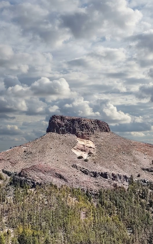
After the hike, many visitors extend their journey to nearby landmarks. The Piedra de la Rosa, a flower‑shaped stone formation near kilometre 22 of the TF‑21, is a curious stop, though its appeal lies more in its geological oddity than in its photographic potential. The Izaña Observatory, though closed to the public, remains a striking sight from the road, its domes gleaming against the volcanic backdrop.
Arenas Negras Recreational Area
Further down the north‑western slopes lies the Arenas Negras Recreational Area, at 1,239 metres. This site, near the Trevejos volcano, offers a different perspective, where Canary Island pines rise against dark tephra deposits. Trails for walking, cycling, and horse riding begin here, and the adjoining camping area welcomes tents and mobile homes. The contrast between green forests and black volcanic soil creates a landscape both serene and dramatic.
Variants and Extensions
The Montaña de las Arenas Negras loop can be extended by linking with the Siete Cañadas trail, creating a longer traverse across the caldera. Other options include routes to La Fortaleza or Montaña Blanca, each offering unique perspectives of Teide’s volcanic theatre. For those seeking variety, the Alto de Guamaso hike begins at El Portillo and can be combined with the loop for a fuller day.
Practical Advice
The trail is well‑marked and maintained, but the connecting path to Siete Cañadas is less frequented and can be harder to follow. Refreshments are available near El Portillo, but carrying sufficient water is essential. Shade is scarce, and exposure to sun and wind is constant. Sturdy footwear and sunscreen are recommended, and in cooler months, warm clothing is necessary.
Rock Climbing
Adventurers find challenges in Las Cañadas del Teide. Routes range from sport climbs at La Cañada del Capricho to the dramatic walls of Roque La Catedral, a volcanic monolith rising 120 metres. Climbers can also tackle the north face of Roques de García, rewarded with views across Llano de Ucanca.
The Cable Car
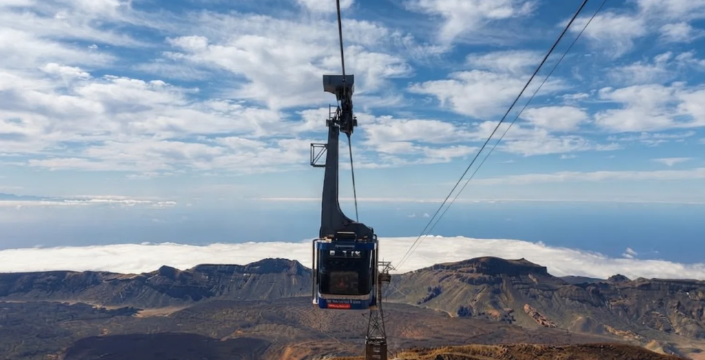
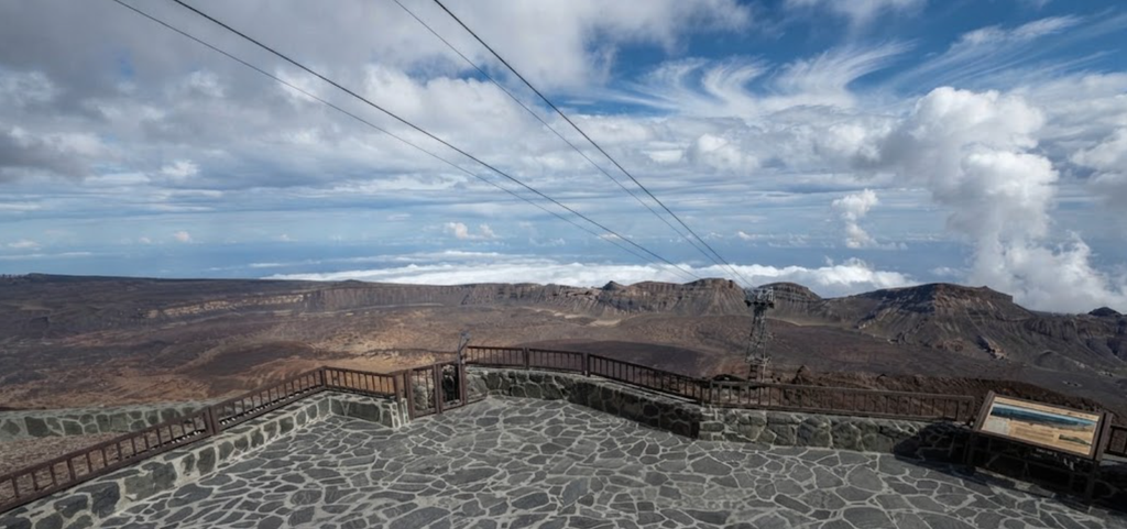
The Teleférico del Teide, built in 1975, carries visitors from 2,355 to 3,555 metres in eight minutes. From the upper station, short trails lead to viewpoints such as Pico Viejo and La Fortaleza. Trail 10, the Telesforo Bravo path, reaches the summit but requires a special permit booked well in advance.
Summit Hiking
For those who prefer to climb, Trail 7 from Montaña Blanca is the classic route. It takes 7 to 8 hours, with altitude making the ascent demanding. Many hikers once stayed at the Altavista Refuge at 3,259 metres, but it remains closed. Overnight bivouacs are possible only with a permit.
Stargazing
At night, Teide becomes one of the world’s premier stargazing sites. The Teide Observatory in Izaña hosts astronomers, but casual visitors need only stop at a viewpoint to see the Milky Way spill across the sky. Conservation laws ensure minimal light pollution, making the experience unforgettable.
Visitor Access
Entry to the park is free, but summit access is regulated. Permits for Trail 10 are issued online, valid for specific dates and two‑hour slots. Other trails — including PNT 07, PNT 09, PNT 23, and PNT 28 — also require authorisation. From 2026, new eco‑tax measures for non‑residents are expected to manage visitor numbers.
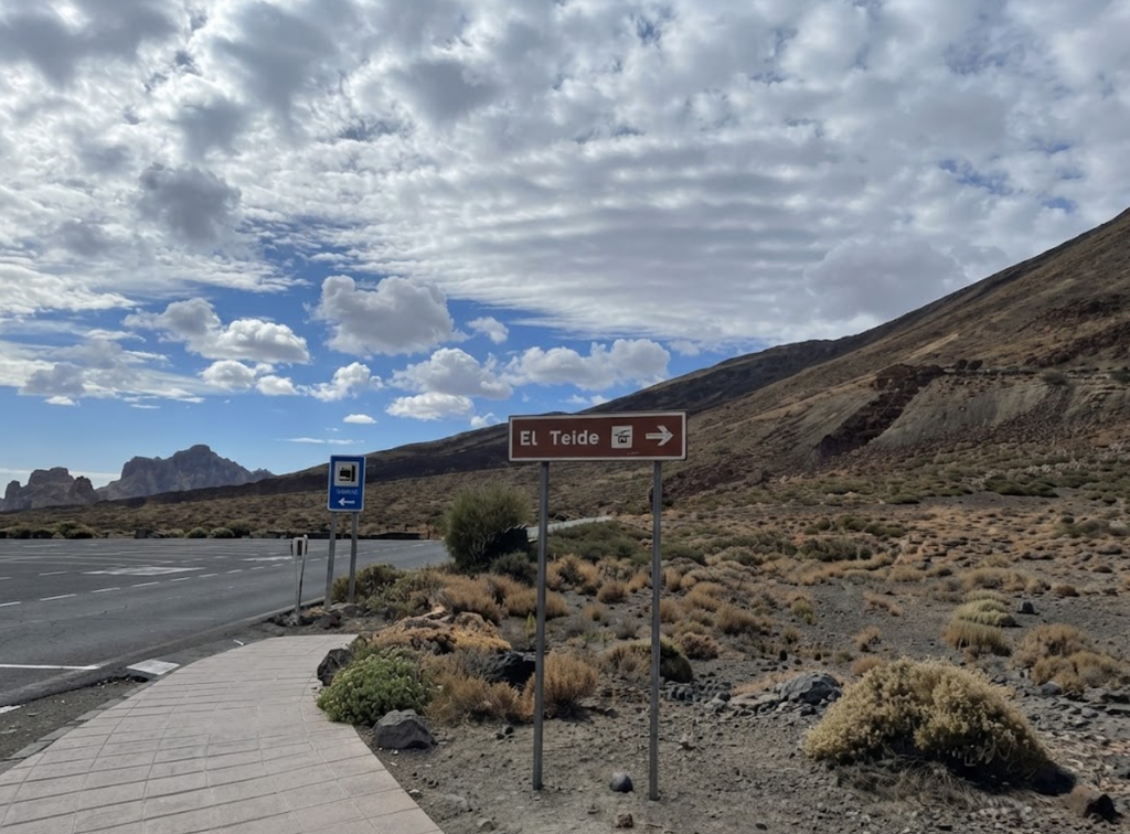
A Landscape of Contrasts
Teide is not a single attraction but a mosaic of experiences. Lava fields stretch into horizons, scarlet flowers bloom against black rock, and cable cars skim the clouds. The park is both a geological archive and a living wilderness.
Practical Notes
- Altitude: Oxygen levels drop by around 20%, making even short walks challenging.
- Weather: Temperatures plummet at night; UV rays intensify during the day.
- Transport: Car hire offers flexibility; buses provide budget access.
- Permits: Apply early for summit access; spaces fill weeks ahead.
Teide National Park is Tenerife’s volcanic heart — a place where geology, ecology, and astronomy converge. It is not a destination to rush, but one to absorb slowly, trail by trail, view by view.